Aug 29, 2015

Fort Channarayanadurga - part 2

..continued form Fort Channarayanadurga - part 1.

December 28, 2014
Stairway to the summit. Eranna is getting colder as we climb higher.. but his enthusiasm is firm. This stairway is really steep, steps are short, had to place my feet side diagonally.

View from one gateway; ruins of structures which might have been store houses or military barracks. The H-shaped wall might have been a stable.

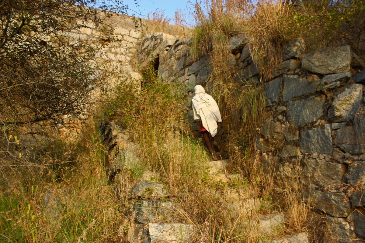
Another flight of steps, one more gateway and we'll be reaching the innermost part of this fort.

The innermost gateway; the brick portion of the wall is most probably added during Tipu's rule. Similar brick-mortar toppings can be seen at many forts such as Devanahalli, Nandidurga, Savandurga, and many more.

The zigzag path to the doorway. Love the color combination of the wall

A very tight entrance.. when under watch, its almost impossible to enter or leave without being  noticed.

This is core and the highest part of Channarayanadurga. A shoulder ran all along the walls and beyond the walls are steep faces, hard to scale them.

Lot of stone has been hacked away to level the floor, perhaps the same stones were used for constructing the rampart walls. This level gave a commanding view of the surrounding plains and hills. Madhugiri is visible clearly from here but not in this hazy condition, Surely a signalling system existed between the network of forts consisting of Channarayanadurga, Madhugiri, Midigeshi, Madaksira, Gudi Bande, Bhasmangi, Ratnagiri, Pavagaada and few other forts I'm not aware of.


A bend in the wall and we are the narrowest pert of the summit. Actually the walls converge.. like in a V. This is the part which can be seen from the village.

The western wall, Close look at the wall; sloped top runs off rain water, brick and mortar stand the test of time. This mortar will be a mix of sand, lime, wheat flour, and jaggery. I'm trying to imagine the time of construction... how they transported material, how they stored them, how they were moved from the base to hill top,.. did a human chain work like an escalator? Did they ever leave a painting of the construction site?

Armed soldiers would be scanning the plains and slopes. Did they work in shifts or would they be stationed here for weeks/months? Were soldiers/officers paid salaries? Were they allowed to take leave?

View through the gateway; Eranna stand at the stairway top.

Time to leave.. we descended one level and looked up at the eastern wall and bastions. Bastions hill tops, particularly the ones on edges  are usually sharp cornered. I think its easier to built square bastions than round bastions.

We pass through another gateway.. wonder how old these walls are.

This wall is part of the structure which might have been living quarters for military officers. Remember seeing a similar wall at Madhugiri too. When builders had the technolofy to built flat surfaced walls.. why are these blocks sticking out? Is this a wall scaling training wall?

Eranna takes a break. Rock steps make climbing easy in wet weather. We head towards the temple.. an incomplete structure. The presence of a gateway is a clear indication of a wall around the temple. For some reason it remained incomplete.

The temple architecture seems like Vijayanagara style but it may not have been built during that period. Probably post Vijayanara empire period builders adopted that style.. a simpler version.

View from the temple.. the summit crowned by bastions and rampart walls. Eranna suggested me to take this shot.

An ancient shelter probably a sentry post during the fort's hey days. The water body seen below is the village's source of water.

Back at the village, Eranna takes me to his house. He's a family man with two daughters and a son. I thank for his time and patience. Really a good way to start a day :) We drove out of the village, found a peaceful spot next to the road for a break. Thanks to Manjula, my host at Tumkur we had home made idli-chutney for breakfast. Next on the list was Ratnagiri fort, its just Karnataka-Andhra border.. so we will be driving about 6 kilometers into Andhra.

Chennarayanadurga fort co-ordinates: 13°35'46"N   77°12'30"E
.........

Aug 22, 2015

Fort Channarayanadurga - part 1

Dec 30, 2012
Gulli, Deepak and I were on a day trip, My plan was to see two of three forts.. Madhugiri, Channarayanadurga and Midigeshi. That was the day 'Thane' was blasting India's east coast and its effect was seen in Tumkur district. Sky was overcast, dark heavy clouds, a constant drizzle. We started with Madhugiri.. as we went higher up the monolith, fog got thicker, visibility became shorter, windier and colder. It was Deepak who lead, if not for his earlier climb we would not have reached the summit. Descent was slow because of wind, our energies sapped when we reached the base. Lunch was mudde-saru at a small eatery. It was my suggestion we head towards Midigeshi, purpose was to preview the hill.. only the base was visible, the top was shrouded in mist. On the way back we tried to locate Channarayanadurga.. it was interior.. we dropped the plan. We reached Tumkur outskirts, stopped for a while, had fresh n hot tea.. it was amazingly refreshing! With our energies recharged we cruised towards Bangalore chatting away noisily.

Dec 28, 2014
Left Tumkur early by a cab, drove via Kortagere and reached Channarayanadurga by 6-15, its a small village right besides the bill, at the village square people were huddled around small fires, some smoking beedi or sipping tea. As usual I spoke to people and found a guide. Eranna was picked  as my guide. That was quick, no waiting time at all. We started climbing.. I remember reading.. the climb was steep at places.. true it was steep but the surface was friendly, it offered superb grip.. as though it held you firmly. Eranna was nimble as a goat, he climbed as though he walked on plain land..

Eranna told this is where the 1980's Kannada movie "Bangarada Jinke" was made. He was a kid when the movie was shot. Ropes were left down the slopes so that actors could climb easily. Eranna told this is the spot which is shown as a cave entrance.. the dark space between the rocks was the cave's mouth. Eranna insisted I take pictures of this spot.. "people came from far places to see this place" he would say.

Eranna suggested we go right up to the cave's mouth, seeing the vegetation I decided we skip it.

The air was cool, mild breeze blowing from east, cloudy sky with golden rays escaping from the gaps. We got closet to the fort wall. Eranna said the wall seen here is just the beginning.. we still have a lot to climb. Tracks of slow flowing streams in different colors.. strokes of nature's paint brush.

Besides tracks of uniform width we have varying width too like the one seen here.. this one looks more like a river and reservoir on a map. Also tracks are of two types- gloss and matte. In this view the fort's summit is peeking up from the wall.

We approach the first gateway on the hill, long back there could have been one near the base, in the present day village.

Sources say Channarayana Durga was built in the XVII century CE by a feudal king from Madhugiri named Channappa Gowda. It was also ruled by the Marathas, Wodeyars of Mysore and Tipu Sultan. Close to the doorway, as you enter the fort, on the right hand side is an inscription in Devnagari script. In the first line, one word is 'Chandrayanadurga.' It is possible the inscription could be of Maratha period. So, was that the original name?

Close the entrance are groups of vertical lines which I believe are workday records of a person who was involved in construction work. Another marking seen close by was a an equilateral triangle accompanied by intersecting lines. I remember seeing a similar drawing at Chandragutti fort and probably at Nidgal fort too.

As you enter the gateway, its a curved path, a standard design to slow down (or confuse) enemy entry. Eranna waits at the doorway as I shoot. Notice the doorway arch, its Islamic, Tipu's signature on forts. Remember seeing this arch design in Gooty, Koppal, and many other forts. Just like other historical spots, I could treasure hunters handiwork here too :(

The gateway interior.. built to be cool in summer and warm in winters.. a platform which works as a security office.

A short climb from the gateway are several structures.. a temple, a granary, and a water tank. Water looked fresh and clear. This scene immediately reminded me of the water tank at Savandurga. Cracks in cloud screen had widened, golden and pink background was visible.

We have a long way to the summit.. with several stages and gateways in between.

An east facing temple, seems like Vijayanagara architecture but may not be of that period. Unlike a traditional temple, this one doesn't have a Shikhara but it has a terracotta crown. It is quite common to see terracotta crowns in Tumkur district, especially temples close to forts. The temple has two parts; a Sabha Mantapa and Garbhagudi. The sanctum's entrance is flanked by two characters holding trishul and damaruga (trident and hand-drum). I don't remember seeing any idol inside rather the interior was dug out :( Right behind the temple was a cylinder like structure built of dressed blocks.. I guess it was a granary or it could be used to store arms and ammunition.

View from across the water body. In the background, slightly to left of the temple is another temple.. scanning to the right.. is a gateway. Up the hill,at the mid-level are bastions and walls. The summit level is also clearly visible. across the waterline is a red patch..

We move up to check out fortification on the right. A group of bastions and walls secure this part of the hill. There's a four pillared shelter which might have been a security office for this part. In the foreground, just ahead of me is a large red patch with flow lines.. doesn't it look like blood? I could see many such patches. Is it an indication of richness in iron in this stone?

Eranna said there's nothing much to see here and also its a dead end. However we went up.. those walls were created to stop any attack from this side. These bastions provided a good view of this side of the hill. The reservoir is triangle shaped except the sides are curved lines instead of straight lines. Sky was clearing rapidly, it was blue sky with scattered white clouds. From where I stood, just behind me was a rampart wall.

Eranna suggested we walk along the wall to the gateway to the next level. Looking back the way we came. We looking towards north. A short distance from here was the gateway.

Looking down the slope.. the temple on the right, first gateway and on the plains is the village. Eranna was a patient man.. like most my friends I'd met during my earlier trips. He would wait until I finished shooting, made sure I took the safest possible paths, answered my questions..

One of the walls had a row of holes (plugged with iron stubs) ran along the base of the wall. Unlike earlier fort walls, this wall is built of rough cut stones bonded with mortar. Probably a row of iron spikes marked the wall's base and also held the stones in place during construction.

In through another gateway, the final climb lies ahead. From here its hard to guess the way up.. if enemy forces ever made to this point they would have to spend some time to figure out the way ahead.

this post will continue in Fort Channarayanadurga - part 2.

Co-ordinates: 13°35'45"N   77°12'38"E
.........

Aug 15, 2015

Sunset at Devarayanadurga

Devarayanadurga hills are near Tumkur. As the name indicates, the place was a fortification from ancient times. My first visit to Devarayanadurga was mid 1995, a solo ride from Bangalore. It was kind of stop n go trip. Though I drove past these hills several times, another visit never materialized until..

December 27, 2014
I was at Bangalore on vacation. A 3-day trip to visit forts near Tumkur was the plan. The plan was know to my friends Umesh and Manjula, residents of Tumkur. I arrived at their home by 4 PM, met Manjula's father Mr.  Channappa and son Vinayak. We chatted and snacked for a while. I suggested we go to Sri Siddaganga Matha, it would be my first visit. So it was Vinayak, Channappa and I.. Close to the Matha entrance was a  mile stone which said 11 kms to Devarayanadurga. A change in plan, we decided to visit the fort. It was almost sunset time.. Had to drive faster than usual.. We got glimpses of ruined fort walls, a gateway and a watch tower.

On this hill are two temples- Bhoganarasimha temple and Yoganarasimha temple -the former is at a mid level and latter is close to the peak. Also there are couple if traveller's bungalows couple of kilometers from Yoganarasimha temple.

Besides the road, an ancient foot path still exists. Many people take the footpath connecting the two temples. This Mantapa is a rest place for those taking the foot path. The Mantapa has been renovated recently, so is the stairway.

I parked my car where the roads ends. We were just in time for the sunset, within a minute Sun would be behind the hill.

That's Channappa and Vinayak. I shot with two different camera settings; here Sun and sky have become a patch of white. The other photo sky in red and golden yellow but my friends are in darkness..

Two bastions flank the gateway to the fort. Going by the look of the stone walls, I feel they were constructed during the rule of Hoysalas or even earlier. Notice the top part of the bastions- they are mud walls. At some point of time, one of the rulers got the walls heightened. I'd seen mud walls in forts only in North Karnataka, places like Gurmitkal, Chandriki and Lakshmeshwar.

On the left bastion's base is a passage entrance - this is believed to lead to a tunnel which connects to some far away place. A bus load school children from North Karnataka were visiting this spot.. some boys ventured a few feet into the tunnel.. the darkness inside wasn't friendly.. they came out heeding their friend's words. I could hear Vinayak inquiring with his grandpa.. what's in there?

This is one of the inner walls. A short distance to the temple remains. I think it was here I saw a poojari hurriedly descending.. his day's duty was done.

Sun had gone down, gold and red were rapidly changing to blue and grey. In the foreground are patches of white.. that's where Bhoganarasimha temple is and also the temple staff homes.

Another gateway just before the temple gates.

Just beyond the narrow passage between the two walls is Yoganarasimha temple entrance..

..alas, it was locked. If we had reached half an hour earlier, we could have been in and probably reached the hill summit. Looks like its not time yet.. I have to be patient.

Another look towards west.. bands of gold and orange dominated the sky.

Well, nothing more to see for now, we decided to drive back, Channappa suggested we check out the view from the traveller's bungalow but it's gates were locked. Close it was a ruined structure which looked like a living quarter, it had a lovely view.. for some reason it neglected.. perfect den for drinking and gambling.

That's a partial view from the ruined structure. We could see fields and houses below... lights were coming on and chimneys were smoking. Men were returning home and women folk were preparing to cook dinner..

The picture looks bright, thanks to the camera but it was darker. We left the spot, driving back towards Siddaganga Matha and Tumkur.

.........