Apr 28, 2012

Madhugiri Fort - part one

Dec 30, 2011

Deepak, Gulveer and I left home quite early. My plan was to visit 3 forts for the day- Chennarayana Durga, Madhugiri and Midigeshi. I think as we passed Nelamangala we saw tiny raindrops in the windscreen. The drops got larger and after a while the wiper was on. Oh, what a day we chose to climb a rock hill! Never mind, the weather might change when the Sun is out ...we drove on.

Deepak was suddenly hungry when he saw Kamat near Dobbaspet. I was hoping to taste thatte-idli in one the small towns or any of the villages. Anyway, we had warm idlis and vade. At Dobbaspet we left NH4 to join s SH to Kortagere. As we drove deeper into the country side, weather was slightly different. We had dry patches in between bu weather was wet most places.

As we neared Madhugiri we could see the lower portion of the monolith, clouds covered the upper portion. At the town entrance a large billboard welcomed visitors. There it is- the only clear view of Madhugiribetta for the day.


Madhugiri Durga (Kote): Madhugiri Hill is the most popular monolith rock hill in Asia. The fort is 3935 feet from sea level. Within the fort are two water tanks- Bheemana Dhone and Navilu Dhone. At the top of the hill is Gopalakrishna temple. Close to this hill is Anandarayana hill. The hill is shaped like a young bull's horn. A stranger to this hill finds it difficult to climb. The fort was established during King Chikkappa Gowda. The fort was further strengthened during the rule of Hyder Ali, Tipu Sultan and Mysore Kings.

Google Map screen-shot of the Madhugiri Betta. The hill is about 1200m length wise. Air distance between start and end points of our trek is about 800m. Going by Google Terrain, the hill is about 300m (984 feet.) high.


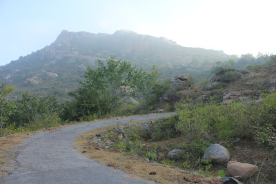
We are in the fort now, at the base of the hill. Deepak and Gulli are walking on the paved foot path.


Massive boulders connected by thick walls definitely kept out enemy forces.


A number of questions arise- how the engineers planned; how workers hauled heavy stones; how tools and implements were maintained; did kings take care of food for workers; medical care for injured workers; did work stop in rainy season?

We are looking at the North-eastern face of the hill.


Two doorways side by side.


Steps cut-out in rocks.

Another gateway. Roof slabs are missing leaving out the frame-work of columns and beams.


That's Madhugiri town. Going back in history, Venkataramana temple and Malleshvara temple would be noticeable easily.


Looking towards West ...that must be Siddapura Kere, also known as Baba's Lake.


Third gateway. Notice the smaller doorway to the left? Probably wooden doors were installed to secure the entrances.


A long way up to the top. This was one of the moments of less dense clouds around the hill top.


A turret cum watch tower to our left. I wonder why stones are left sticking out of the walls.

This must be Bheemana Dhone ~ Bheema Tank. According to the information on the board there's another tank named Navilu Dhone ~ Peacock Tank. I do not remember seeing Navilu Dhone.


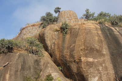
Engineers have used this particular rock formation cleverly ...a secure turret to keep watch on the town below and the main entrance of the fort. The ramp leading up this turret is pretty steep. Perhaps a cannon was placed in the turret back then. A speck in the center of this picture is Gulli standing at the base of the ramp.


While Deepak and Gulli rest I explored the fortification walls on the south-eastern side. The little doorway straight ahead is entrance to Hanuman temple. The dome on the left must have been used to store food grains or oil.


Jai Hanuman. Every fort must have Hanuman, the God of strength.


This small doorway is the only exit in this side of the fort.


A watch tower ...typical Hyder-Tipu architecture. I wonder what's the purpose of that arch. Few cactus seen here are size of small trees. Weather was still same, no signs of clouds clearing away for the day.


We regroup and start our climb. I pause to catch my breath and admire the view. The massive turret rock looks small now.


A massive boulder we just passed by. I convey my thanks to the people who fixed these railings, it made climbing easy in wet weather.


In through another gateway and we look up to another gateway.


From this point on we could feel the wind ...Thane was blasting India's East coast.

I had to split the article into two parts; click Madhugiri fort - part two to continue.

.........

Apr 26, 2012

Huthridurga: South hill

Huthribetta's South peak as seen from Hutridurga North hill. I leave behind Durga, Deepak, Gulli and our guide Siddappa and go ahead towards the village.


At the village, few locals point me the path leading up the hill. As I was struggling to find the right path, Doddayya Aravanna appears behind me and volunteers to be my guide. Huthrdurga fort in the background.


One of the two gateways can be seen clearly. It's a short climb but a tough one.


I wonder how engineers of those planned a fort on a wild rocky hill.


We are about half way up the hill.  Beyond this gateway, the path leading up the hill was completely blocked by thorny bushes. I suspected the path was blocked intentionally. If we had one hatchet, we could have made our way up. I was tired and hot and felt my tummy saying hungry.


Clear view of the northern part of Hutribetta.


and the plains below.


We decide to head back. Looking back toward a gateway.


Back at the village we stop at Doddayya's home for water and buttermilk. he introduces his family- wife and college going daughters. Doddayya and wife are happy to pose for a picture while the daughters vanish indoors. I thank them for the buttermilk and take their address to post the pictures. Back at the school, where the car was, the gang had found another place to rest their weary legs. Siddayya was also around, we thanked him for being with us.

On the way out, I opt to take a short walk through this gateway. This actually is the main entrance of Huthridurga. A wall along the edge connects the two peaks creating a line of defense.


Bye Huthridurga.


September and October should be a good time to visit this hill fort. The hills itself would be green with varieties of plants and insect life.

We drive back to Yalagalwadi handpost and stop for lunch ...anna-saru, bajji and buttermilk. Our next destination- Jaalmangala hill fort.
.........

Apr 21, 2012

Huthridurga: North hill

Suryadeva says good morning near Magadi.

One of the many Kempegowda towers standing alone on a rocky hillock some where between Magadi and Donakuppe handpost.


We drive by villages and hamlets enjoying the fresh morning air. Durga wanted to touch this band of low-hanging mist :)


At Donakuppe, we asked for directions to Huthridurga. Turn right, first you get Yalagalavadi and then at Santepete as for Huthridurga. We turned right before Santepete driving past a hill but no sign of any ruins. Few ladies washing clothes in a pond told we had to drive little further from where we turned.

At Santepete, we found the road winding up Hutribetta. Now the fort is visible.


Suryadeva is blazing his way up the sky driving away mist.


The road went through Huthri village. The village is nestled in the valley formed between the two peaks of Huthribetta. We parked Deepak's Santro near the only school of this village. As usual i tried to find a guide. No such luck, everyone was busy. A young man gave directions pointing at the hill ...any help is welcome rather than no help at all. We stuffed our backpacks with breakfast items and water bottles.

Welcome to Hthridurga.


The outermost wall on this peak. Remains of a watch tower can be seen to the extreme left.


The climb is not very steep here. There's the second ring of fortification.


Looking back towards the way we just came. The white speck is our to be guide- Siddappa. When he caught up with us, he told us that freed himself from some work to show us around. Nice of Siddappa :) Nothing like a local showing us around. Huthri village is like a little baby between two pillows. We are climbing the North peak. The South peak, seen in the background seems wild.


Siddappa lead the way. Deepak and Gulli were lagging behind us. I guess this is the second gateway. Notice the fish motifs over the doorway?


In some ways, Huthridurga is similar to Gudibande fort ...the way rock formations are utilized to create gateways. The third gateway.


The hill has interesting flora. We saw few colorful butterflies too. More bastions and walls. We climb up steadily. Durga starts her raga ...I'm tired, go slow.


Another gateway. With a good rainy season most of this path would be blocked by bushy plants.


We pass by a small temple dedicated to Lord Hanuman. The terrain changes slightly ...it's more rocky and open now. We have climbed quite a bit. Durga was hungry now.


The penultimate gateway.


We decided to wait for Deepak and Gulli to catch up. Siddappa got busy gathering firewood. I noticed stoppers at the base of the walls- wedge-shaped stones driven into dead-holes. I do not remember seeing this anywhere else.


My idea was to breakfast at the summit but Durga refused to move. Siddappa was shy to join us, he kept himself  busy picking dry wood. On the way back he would pick them up ...enterprising character. Bread, cheese slices, better and peanut butter were on the menu. I took a few minutes off to climb up little for this picture.


I found these marks inscribed from where I took the picture. Look like some types of game boards. Perhaps the guards on-duty inscribed these to keep themselves entertained. A good way to stay alert too.


An ancient temple dedicated to Shiva. A user on Wikimapia has marked this temple as Sakareshwara Temple. I do not remember if Siddappa mentioned the name. A small Nandi lies abandoned near the steps leading up the rock on which the temple is situated. Water in the pond about 20' long and 8' wide was not really clean but Siddappa told that this water is used for rituals.


I explored a bit and found few ruins of living quarters for sentries. We go exploring further ...from here we could see two sheer cliffs. If not for Siddappa we would not have found the narrow concealed path between two massive rock  formations.


Back into the open again. More ruins of shelters. I wonder what that circular stone was being made beofre it was abandoned. A grinding stone? A wheel?


Few minutes back I was standing at the tip of the rock. The spot where I shot this picture is also close to another edge and another hidden path ...I located it.


Deepak, Durga and Gulli park themselves while I urge Siddappa to show more of this hill. These rocks form a rhino's nose.


Siddappa stand near the ruins of a rain water tank under construction.


Two rectangles embossed into a rock bed. That is a sign of a planned shelter. A rectangular pillar would stand in that depression.


A slowly crumbling remains of a watch tower.


Siddappa has gathered another load of firewood and I was ready to turn back. We regroup and retrace the path. On the way back  decided to go up that hill, even if it meant going alone. I went ahead alone leaving the group behind to take their own time climbing down.


One last look at the northern peak of Huthribetta. I guess this is pink granite. My wishes that no one ever thinks about carving up this beautiful place.


Google Map screenshot-


A - first gateway
B - second gateway
C - third gateway
D - fourth gateway
E - firth gateway
F - temple & pond
G - sheer cliff faces
H - narrow passage
J - rain water tank


Huthridurga Coordinates: 12°57'41"N   77°7'25"E
.........