Cinemas have influenced a part of my life. Right from childhood days I liked realistic stories, the types which you feel could happen or have happened for real. Such movies had a certain quality in terms of location, direction, acting and what not. Some of my favorite movies are- Ondanondu Kaaladalli, Baraa, Hamsa Geete, and Minchina Ota. I saw these movies during school & college days, on TV. Each one them had a lasting effect, they stayed fresh in my memory. Hamsa Geete was shot in & around Chitradurga fort. Baraa was shot in and around Bidar, a few shots were within the fort. By the end of the movie, a wish to see Bidar fort formed in my mind.
In 1991, I completed engineering and started working with my father in the electronic weighing systems business. In 1994 I got a Hero Honda Splendor, a 100cc four-stroke bike. The engine felt smooth, exhaust note was a mild thump and fuel consumption was a frugal as it could get. Even in city conditions my Splendor ran 70 km per liter. It was one product which lived up to its tag line- fill it, shut it, forget it.
During the first few years of my working life, I went on short trips with my friends. Savandurga and Shivagange had been our favorite destinations. Of all my friends, my trips were mostly with Anish, Gulli and my brother. Before I got my Splendor, I had been on long distance rides on my Kinetic Honda. Some of the longer trips on both bikes are-
In 1995 the idea of riding to Bidar formed. Gulli and I discussed it a few times and planned a trip in October 1995. Sometime September 1995, while running around on office work, while riding my Kinetic Honda I brushed against a mini truck locking the front brakes which tossed me & my bike into the air. The accident left my right hand and arm injured, had to undergo surgery under anesthesia to stitch up the wounds. The trip was postponed until my hand healed completely. Months went by, my hand was close to normal. In January 1995 we revived our plan and froze the trip dates. It would be a two week trip starting third week February. The tentative route was- Bangalore - Hospete - Hampi - Bijapur - Bidar - Bijapur - Dharwad - Goa - Mangalore - Bangalore. I can't recall the exact dates, I think we started just before a weekend.
Gulli and I were all set. Our things stuffed into two backpacks, helmets, a camera and a foot pump in case of a flat tire.
Day 1: We left home early morning, air was chilly on Bangalore-Tumkur highway. We stopped at Ravi Idli Hotel for breakfast and continued our journey. The landscape was familiar.. lot of coconut plantations on this stretch. Though a two lane highway, we never felt unsafe. We rode between 50 and 60 kmph, sometimes going up to 70 while overtaking. At Chitradurga we left NH4 and entered NH13. Here we saw a different landscape... barren land as far as the eyes could see. The road was something to remember... the edges of the lane road were badly eaten away, huge potholes lined the edges. Overtaking trucks & busses was almost impossible until another truck or bus came in the opposite direction. Both drivers had to literally stop, get off the road to pass each other. Before the vehicle got back on the road completely was our opportunity to overtake! We stopped at one of the dhabas for lunch. Gulli was baffled seeing a truck driver drink coconut oil just before starting his lunch. My guess was that coconut oil worked like a laxative. Drivers life is tough, 8 to 10 hours at the wheel, its almost sedentary.
We continued our journey, the road was better as we neared Hospete. About 25 km before Hospete, we happened to notice an ancient temple off the highway. It was a Vijayanagara period temple. The temple had a large pillared hall. Each of the pillar's four faces carried motifs of some animal or bird or a human or some imaginary creature. We must've spent 30 minutes at the temple before resuming our journey.
We reached Hospete late afternoon, we checked into a room at KSTDC Hotel close to TB Dam gate. We went up a hill to get a view of Tungabhadra dam and reservoir. A peaceful place it was. I'm not sure if we went to see the musical fountain at the dam gardens, its a popular spot for local people.
This is a trace of our route on Google Maps. Had Google Maps been available, our trip might have been a month long, or two month long. Back then, our source of info was TV & print media, brochures from KSTDC and maps. Anyway, it was a different life back then.
 |
| 2500 km in 13 days on a Hero Honda Splendor |
Day 2: Gulli and I headed to Hampi. We started the tour from Sasivekalu & Kadlekaalu Ganapati and then went to Virupaksha Devastana. I remember buying a brass bell from one of the cart vendors. From Virupaksha we walked along the river to Chakrateertha and Sugreeva cave. I think we climbed the Matanga Gudda.
 |
Virupaksha Devastana | Two-storied gateway
Anjanadri Betta & Tungabhadra at Hampi |
We rode around covering Lakshmi Narasimha, Badavi Linga, the underground temple, Hazara Rama, Zenana Enclosure, elephant stables, Mahanavami Dibba, the stepped well, and Vittala Devastana, At Vittala temple, we engaged a guide who played the musical pillars while we listened to the tune with our ears pressed on to the pillars. After the tour, we invited the guide with us for refreshments. We sat under a Neem tree eating banana, a monkey appeared, our guide shared a banana with the monkey. I felt a few monkeys trusted the kind man and ate what he gave. We saw a few other monuments before winding up for the day. We retired early since we had to wake up early the next morning.
 |
Lakshmi-Narasimha | Achutaraya Devastana
Stepped tank of Hampi |
Day 3: We left Hospete around 4-30 am. Morning air was chilly and misty. As usual I rode between 50 and 60 kmph. By 7-45 we were at Hunagund where we stopped for breakfast. I think the eatery owner suggested us to visit Aihole and Pattadakal since they were just 22 and 44 km away. We had time on our side, so it was a yes. Pattadakal is easy to cover since we got to see the temples in one complex. However monuments of Aihole are scattered. At Aihole we engaged the services of a guide who showed us Durga temple complex, Ravalapadi and the Buddhist Chaitya. Now I feel we should've stayed at Aihole for a day or two, finding a host wouldn't have been an issue. The person in white shirt was our guide, a very humble, polite and friendly person he was.
 |
Ravalapadi, Aihole | Someshwara Devastana, Pattadakal
Ravalapadi | Buddhist Chaitya, Aihole |
After Pattadakal and Aihole we headed back to Hunagund. We picked out backpacks from the eatery and continued our journey towards Bijapur. By 1-30 we were at Kudala Sangama cross where we stopped for lunch. We found a khanawali offering home made jolada rotti oota. Without a second thought we were for it. The most memorable item was curds served in mud pot. Never before had I tasted curd so fresh and creamy. Same with Gulli. We continued our journey, reached Bijapur by 4-30 or so. We checked into a hotel, freshened up and headed out to meet a relative and then check our a few monuments. I think we saw Bara Kaman and Upli Burj.
Day 4: We reached Gol Gumbaz at 6-00 am. We were the only tourists. We engaged a guide who explained the marvels of Gol Gumbaz's circular hall & the dome's architecture. Just the three of us in the 100' tall edifice. Only the guide was speaking and we listened and nodded our heads. The demo included tearing a piece of paper while we stood diametrically opposite. We heard the raspy sound as though the paper was torn next to our ears. Then the guide struck a match, rubbed his palms ...same effect. As per our guide, the king held meetings with emissaries in this hall. The catch was that anything the emissary group whispered among themselves could be heard clearly across the hall. They had no privacy, unless they managed to have the meeting adjourned and changed the meeting venue. Gol Gumbaz architecture is truly amazing! The rest of the day we spent checking out Ibrahim Rouza, Malik-e-Maidan and other monuments. During the trip no one mentioned the baobab tree. Sad we missed it then and also during my subsequent visits, until I got to know the tree ceased to exist.
Bidar was next on our list. Our plan was to reach Bidar via Gulbarga. When we mentioned this to our relative, we learned that the Bijapur-Gulbarga-Bidar highway was in bad conditions. We were suggested an alternate route Bijapur-Solapur-Bidar. Surely locals know the road conditions, we planned to go via Solapur.
 |
the arcs of Bara Kaman | village kids near Naldurg
Malik-e-Maidan Tope | Naldurg profile across the valley |
Day 5: As usual we started the journey at dawn. The two-lane highway was in good condition, almost flat and lot of straight line stretches. I think we stopped once for breakfast on the outskirts of a town. Riding through Solapur was easy, not much traffic. It was said that Solapur had more Kannada speaking population than Marathi. At Solapur entered NH65 i.e. Pune-Machalipatnam highway, we were to drive till Humnabad, then take Humnabad-Bidar road. Now the terrain was different, we had plenty of curves, ups & downs. On this route is a very important fort called Naldurg, the highway passes right in front of the dark colored rampart walls and couple of bastions. Somehow, we did not think of venturing into the fort. Naldurg is situated on the edge of a valley as you see in the picture above. It was around 4 PM when we reached Bidar, where we checked into a hotel called Bidar International, it was located in an extension area. We had travelled 900 km and reached the northern most district HQ of Karnataka state.
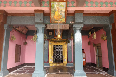
The remaining of the day we visited Papnashi Devastana and Gurudwara.
Day 6: We started the day at Bidar fort. The fort is vast, its perimeter is around 4 km. Its gateways, spiked doors, walls & trenches are sights to behold. We parked the Splendor near the museum which is opposite Rangeen Mahal ~ the colorful palace. Rangeen Mahal is out of bounds for regular tourists. It so happened that a government official was here to see the fort, the caretaker was unlocking the palace door for him. We were there at the right moment, the caretaker let us take a look at the Mahal. The artwork is a marvelous creation of gold paint & pearly stuff, naturally its a delicate artifact, hence the restriction.
First we explored the labyrinth of passages, stairways, chambers and halls around the inner gateway. BTW, the main entrance has an outer gateway and am inner gateway. Each of the gateways has twin double doors enclosing a domed space between them. The purpose of twin door sets is to trap enemies in case of an attack. The maze of passages are confusing, its a play of light & shadow in there, only the familiar can find their way. Strangers can get lost hopelessly. One could take a thousand pictures and still yearn for more. After the gateways, we checked out the massive military barracks and dungeons. We climbed up the structures and peeped in through the light hole. The roof was 20' high and the floor was 10' below the ground. Each of the chambers was 30' x 30' approx. There were canons lying on the floors. There were a dozen such chambers in two rows. Close by was a staircase leading to some underground passage but the passage was barred. I believe there's an underground system of halls & passages for emergencies.
Next we went to the Solah Kambh Masjid enclosure. The most fascinating item in the enclosure was the floral art water fountain pond. On one of the enclosure was elaborately engineered slopes & canals systems of a water garden. The caretaker told that water flowed in such a way it made soothing sounds and cooled the nearby area. Within this fort there are three or four palaces. The caretaker suggested us to check out the massive canon. Never before had I seen such a huge canon- 4' diameter x 16' long x 15" bore. I heard the projectile fired from this canon would land 4 km away. Highly destructive thing this is!
 |
the inner gateway, ramparts & moat of Bidar fort
Solah Kambh Masjid | Badi Tope |
Within the fort are two settlements and a big rainwater pond. The settlements deeper in the fort is close to the pond,, also there are farmlands around it. We rode to this place, it had a temple which seemed important to local people. A break from sunshine was much needed and this place had sufficient shade. Gulli drew water from an open which amused a few kids hanging around. We washed our arms and faces, it was refreshing. We rested a while and then went back to the fort center to check out ruins of an incomplete palace which overlooked the settlement, pond & fields. The foundation part was done with pillar bases in position. The top of the bases had crosshair marks at the center with which the engineers aligned the pillars. It's always interesting to see partially constructed ancient structures- gives an idea of building techniques. With this we called it a tour and headed out of the fort.
Next on the agenda was Madrasa of Md Gawan and Bahamani tombs at Astur. The Madrasa is situated in the dense old town, the lanes were quite narrow. The madrasa's terracotta walls & pillars tower over the surrounding two or three floor structures. The façade is decorated with colorful tiles giving it an unique look. One of the walls which has collapsed long time back has exposed a pillar which is about 80' high. Its a tapering pillar, a telescopic one. Entry inside the madrasa was not allowed. Next we head towards Astur village which is about 6 km away.
There are a dozen tombs at Astur, of them four are massive and rest of assorted sizes. Of the massive ones, three are well preserved while one of the tomb's dome has collapsed, only a third of the dome remains now. Of all the tombs, only one of open to public. That's where we parked out bike under one of the many big trees, plenty of shade, very cool and a peaceful ambiance. Besides Gulli and I there were two other visitors. One of the men told me that he and his friend come here whenever they had something important to discuss about. Indeed, one can think better in a peaceful place as this. We checked out the tomb interior which is decorated with rich designs painted in gold and other colors. The dargah caretaker lit a spot in the dome by reflecting sunlight with a mirror. Apparently a diamond is embedded into the dome at that spot. We must've spent an hour at the necropolis before riding back to Bidar.
 |
Rangeen Mahal | hamlet inside Bidar fort
new found friends at Papnashi temple complex |
A long time wish of seeing Bidar finally fulfilled. We were at the farthest point of our trip, the return trip will begin now. Around 4-30 or so we left Bidar and reached Basava Kalyan by sunset. Kalyana, once an important city, the capital of Chalukyas, the capital from where Basavaveshwara governed King Bijjala's kingdom, was nothing more than a dusty little town. Despite the formidable fort, a temple dedicated to Basavanna, Anubhava Mantapa, the ancient caves of Shivasharana being in and around the town, it was hardly known in the southern part of Karnataka. We checked into a small lodge situated around the town square. The room was a scary sight... stained walls, dirty beds, huge lizards on the walls! We didn't have other options, decided to somehow manage until dawn and we'll be out anyway. Luckily we had our own bedsheets, one little consolation.
Day 7: We woke up at 4 AM, bathed and packed up our bags. While it was still dark, we went to Basaveshwara Devastana. Morning pooja was in progress, we had a good darshan. I think the poojari asked us to visit Anubhava Mantapa which was couple of kilometers outside the town. On the way we stopped at a Kabbina Gana (jaggery mill). Sugarcane juice was being extracted and we got a chance to taste fresh cool juice. We thanked the team leader for the treat, took a snap of the team and left. I can't remember much about Anubhava Mantapa. Back at Basava Kalyan, we had breakfast at a eatery near our lodge. The eatery owner asked us to wait until 10 am to see the fort. We decided against that since we had a 300 km journey ahead of us. By 9 am we were back on Kalyana-Solapur highway. Our destination was an aunt's place at Jamkhandi. The journey was relaxed with hardly any traffic. It was around 2-30 when we reached Bijapur, we had lunch at my relative's place and resumed our journey. Bijapur-Jamkhandi highway was not really smooth, the road surface was wavy. Couple of times, Gulli almost flew off the seat, if not for the backpack, he might have. We had to reduce speed because of the surprises. I remember crossing river Krishna, it was flowing despite being close to summer. The river crossing on this highway is something anyone will remember. We reached my aunt's place by 5 pm or so.
Day 8: Jamkhandi, a small town today, was the capital of a Maratha princely state Jamkhandi. It was founded in 1811 and members of Patwardhan dynasty ruled the state. Jamkhandi town is situated close to the base of a hill range. On the slopes of the hill is the palace complex. The complex has a royal garden, a palace, a temple with a kalyani, a theatre, swimming pool, kitchen house, servant quarters, stables, garages... basically everything a palace needs. The most notable thing about the palace is its clock tower. After the British left India in 1947, the kingdom was merged into India. Members of the royal family shifted to Pune or Mumbai. The palace was vacant but kept in charge of a local family who took care of security. Many parts of the complex were in ruins but interesting nevertheless. Within the complex is Rameshwara Devastana which is quite popular. The most memorable item is a sculpture of a lion. My cousins showed us the palace complex very patiently.
After the tour of the palace complex, we went to the cousin's village Konnur, some 15 to 20 km from Jamkhandi. The most notable historic monument of the village is the Vaade, a fortified house which happened to be my cousin's property. From the village we walked to their farm lands where sugarcane is a major crop. Two interesting things in the fields were- 1. an ancient open will stone walls, steps & arches, and 2. an ancient temple dedicated to Shivalinga probably built during Chalukyan times. I guess Gulli was fascinated with the tour of the village and vaade. So many things were new to him and I was happy to be exposing him to life outside Bangalore.
My cousin's house at Jamkhandi was a wonderful place. The house is situated at the center of the plot with open space on all sides. I absolutely adore that house. One has to be truly lucky to be residing in such a home. Our plan for the morrow was to ride to Dharwad. That afternoon I visited a bike mechanic and got the engine oil replaced.
Day 9: Our journey to Dharwad started early. We went via Mudhol, Lokapur, Ramdurg, Saundatti - which is a KSRTC route. The journey was interesting with views of farm lands, hills and ghat sections. The road actually becomes flat & straight after Saundatti. I think we reached Dharwad by lunch time, we stayed at an uncle's place.
Day 10: Not much of touring on this day except for a visit to Kittur fort. I was more excited about the upcoming journey towards the coastal districts.
Day 11: The journey towards Goa started around 7-30 am. Our route- Dharwad-Alnavar-Ramnagar-Molem-Ponda-Panjim. The road condition was okay, our average speed around 45 kmph. I'm not sure if we stopped to see the churches in Old Goa. Memories of our movement in Goa are sketchy, We checked into a economy lodge in Panjim. The afternoon was spent sightseeing Miramar beach, Dona Paula and few other spots. Dona Paula was the last since we took a picture of the sunset.
 |
Jaggery mill near Kalyana | St Sebastian's Chapel, Panjim
Miramar beach | Shiva's face at Vagator beach |
Day 12: Plan for the day was to explore the beaches of North Goa. I think we started with Sinquerim fort & beach. I remember seeing a puppy asleep in the sand. I tried to wake it up but it was so stubborn it refused to open its eyes. I gave up thinking of the proverb "let sleeping dogs lie." Then we rode up to Calangute and Baga. The sunshine was bright and it wasn't a time to get into water, so we just saw the places and kept moving. The last stop was Vagator beach. We parked the bike, instead of climbing down to the beach we wanted to check out the plateau. The view from the hill was nice since there were slopes on three sides, we could see sea on all three sides. Instead of retracing the path to the parking lot, we decided to take a shortcut. The hill slope towards Vagator beach was covered in jungle and we went in like brave soldiers. The path wasn't really a straight line. We had to avoid thorny bushes and overhanging branches, our arms got scraped. The final bit was really a circus- we had hit a drop of some 15 feet. We were in no mood to climb up and go back to the parking lot. Somehow we found a way by hanging on branches and finally landed on the beach. Along with us came a few red ants. We cleared off the ants from our clothing and rested for a while. We were tired and thirsty. Also, we were sunburnt from all the riding in sunshine. My arms had tanned, the back of my neck, forehead and nose were sunburnt. No pain, No gain, right?
Gulli and I have been into adventures like this earlier as well, like the near vertical ascent at Mekedatu and a very steep descent at Savandurga. Both were scary experiences.
After the tour of beaches we decided to head to Margoa and spend the night there. That evening when we went to a small restaurant for dinner, I bumped into an acquaintance from Bangalore. That was a pleasant surprise. We retired early as usual so that we could start early morning.
Day 13: Our plan was to ride along the coastal line and reach Mangalore by evening. Since we had started early we decided to pay a visit to Gokarna Mahabaleshwara Devastana. The temple wasn't really crowded, I was happy for that. One thing about this temple I'll always remember is the way the poojaris solicited visitors. They literally latch on to visitors and prod them to perform this it that pooja. The way they extracted dakshina is etched in my memory. Anyway, we could touch the Atmalinga and perform Abhisheka which was a nice experience. From Gokarna, we went further south, stopped at Murudeshwar but didn't go into the temple. I think we stopped at Udupi for refreshments, it was a small eatery which served good idlis. As we rode out of Udupi, we saw a procession. The attraction of the procession was two or three people in costumes depicting hairy demons. Later I learned that the procession was part of Holi celebrations. We were tiring fast because of the coastal heat. We reached Mangalore before sunset, checked into a familiar hotel on Balmatta road. We had dinner at a eatery which served local dishes and hit the sack early.
Day 14: This was the last day of our trip. We had breakfast at Mangalore and started the journey. The sunburns were painful. We rode at our usual pace... passing through Sakaleshpur, Hassan, Channarayapatna, Yediyur, Nelamangala. We were back on the familiar roads of Bangalore. We entered our apartment complex around 4-30 pm or so. Parked the bike, took of our helmets and bags and stretched. Aaah! A long time wish realized.
We had travelled 2500 km! As I remember, we filled petrol just 4 times. Splendor had proved its efficiency with a mileage of 70+ km per liter, one oil change and zero trouble. We, Gulli and I, endured the hectic activity of waking early, getting ready, packing up, riding, sightseeing... The sunburnt forehead, nose, neck and arms took a week or two to heal. Never again did we embark on another road trip as this.
.........