Dec 31, 2016

Pocharam Dam, near Medak

The small dam near Pocharam village is across river Alair, a tributary of river Manjira is commonly known by the name Pocharam Dam, it is about 16 kms from Medak town which in turn is about 100 kms from Hyderabad. The dam was built by Nizam of Hyderabad between 1916 and 1922. The dam is simple in design, its made of coarsely dressed granite blocks and lime mortar. The reservoir covers an area of approximately 11 sq. kms and has about nine small island in it. On the eastern bank, within the dam's sight is an abandoned bungalow of Nizam. When the reservoir is filled to capacity, excess water simply flows over the wall. However, at the western end of the dam are gates which can be used to let out water when the water level is below the dam's wall height. The reservoir is surrounded by jungle which is home to a wide variety of wildlife such as wild dogs, leopards, wolves, jackals, wild cats, sloth bear, and varieties of deer. The reservoir attracts water-birds like geese, egrets and cranes. In 1952, Pocharam Wildlife Sanctuary was established.

August 14, 2016
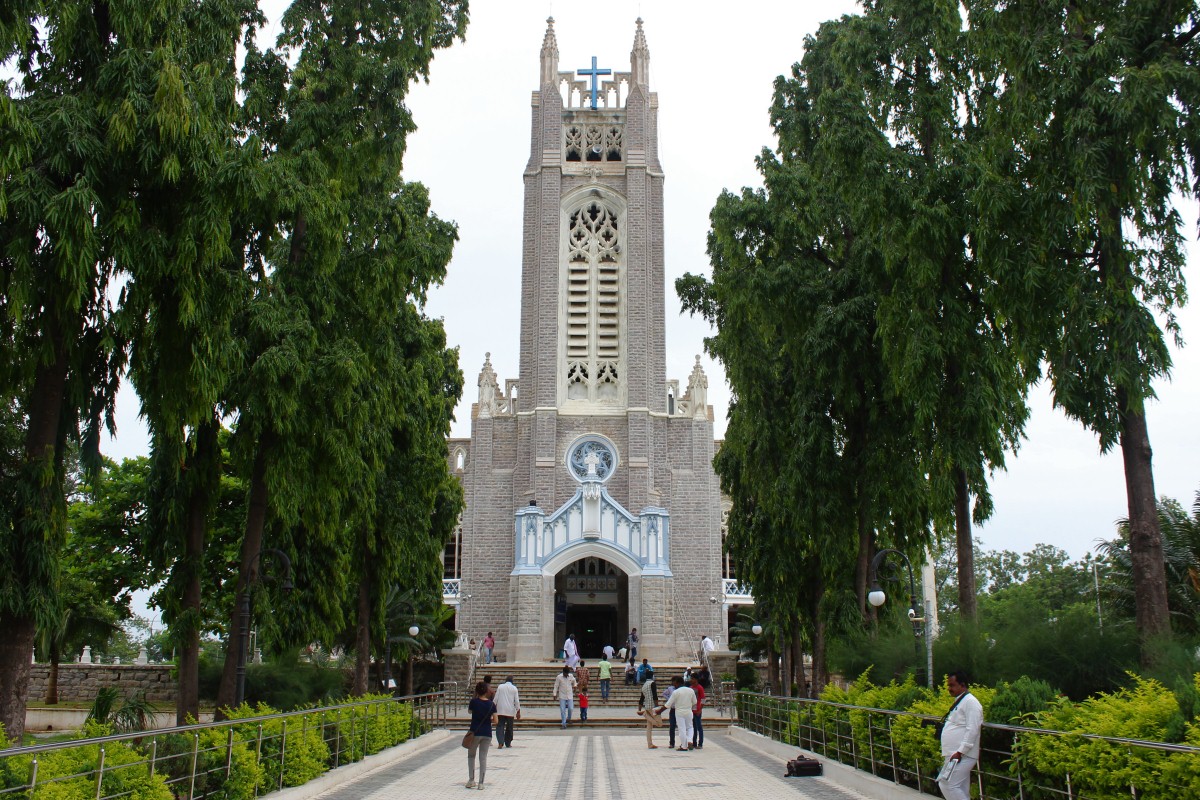
We were on a day trip to see Medak fort and Medak cathedral. Akshay suggested a must see spot near Medak and  that was Pocharam Reservoir. So after the trip to Medak Cathedral and Medak Fort, we drove towards Pocharam. The road was in good condition, it was a smooth drive on a not so busy road. We passed by the fenced borders of the Wild Life Sanctuary. I was hoping to see some deer and peacock, could see none, may be at this time of the day they are deep in the woods. We drove across the river and reached the dam project colony, that's where we realized having missed the road to dam. We turned back, drove across the river and then found a dirt road on our left. It was a narrow uneven path fit for off-road vehicles.. it was a slow drive avoiding the pits & mounds. At one point the road goes across a stream path, a kind of bridge cum wall was built across to facilitate movement of men and vehicles. When the reservoir is up to capacity, excess water flows there. I missed taking a picture of the spot :( Anyway, from the stream the dam is 150 meters, the path ends at the abandoned bungalow. There were 3 or 4 more cars and a dozen bikes already.. people we already flocking in with their picnics.

As we were getting of the car, we could see lot of cream-colored insects flying about. Akshay took them for mosquitoes but some villagers hanging around the place confirmed they weren't mosquitoes, no need to worry. It was nice to see so much water and greenery, felt great to be breathing in fresh air blowing over clean water. It was cloudy with chances of light rain. Good that public was allowed to walk over the dam. The wind was strong at moments, we maintained distance from the edges. The wall is about 16 feet wide and 630 meters long. Water level was about 12' to 13' below at this point where we stand. In the back-ground is the bungalow surrounded by trees.

We'd walked about 200 meters when it started raining, we turned back and rushed to the nearest tree's shelter. The rain lasted few minutes but the cloud cover remained with the Sun peeking out now and then. Back on the wall, all signs of rain was erased by the wind. More cars and people were flocking in..

A flight of steps barely 7' wide with no railings. One person at a time, no side by side walking.

Some brave hearts rode their bikes. Going by the looks, the wall looks solid, it seems to be built at the edge of a rock bed.

We went down the steps to get another view of the dam. Impressive piece of civil work. Its is possible the dam design might have been reviewed by Sir M Visvesvaraya.

There's Pushpa resting on the steps while Akshay chats with a biker from Chennai named Rajnikanth. The biker was on a solo trip on his Enfield Bullet. Notice the wall and floor.. so similar to fort walls.

We are almost at the other end of the dam now. On the water side of the wall is a mechanical device. Apparently it looks neglected and may not be in working condition. It seems like a gate system to control water flow.

The bevel gear and threaded shaft inside these housing hasn't seen grease for years. It definitely seems like a gate-lifting device currently out of commission. Notice how the wall slopes to the right, to allow easy flow of water across the wall. At the far end is the mound of Nizam's bungalow.

We were on the return trip across the wall when I wanted to climb down the steps to the river bed. Two young adventurists started climbing the wall. The closer one here climbed rapidly, very confident. It was a scary sight.. no safety gear whatsoever.

Our climber almost reached the top. Unfortunately, the top 7' or 8' of the wall slopes backwards and that's where his climb ended. There was no way he could move up without a rope. Now comes the difficult part.. descending this would be crazy! Nothing deterred this guy, he made his way down slowly and safely.

Here's a view of the dam seen from the river bed. That's actually a bridge on the dam which lets people walk on the dam when its overflowing.

I was glad to be here, thanks to Akshay. It was nice to spend time in Nature, good break from the hustle bustle of metro life. A family of four were happily enjoying their moment on the rocks, with their feet in cool water and sheltering themselves from the drizzle.

Pushpa had packed our picnic of jolada rotti, madaki-kaal palya and junaka. We found a shaded spot on a rock near the bungalow. It was rather a dry lunch without curds or salad but the items were tasty. After lunch, we rested for a and then I pitched stones over water, a kind of ritual whenever I'm at a lake. The water was choppy so pitching stones was a challenge. Pushpa also tried and succeeded :)

We left early so that it would still be light when we reached home. Driving at night can be tiring and it takes off all the fun we had during day.
.........

Dec 24, 2016

Medak Fort

Medak is known for its rice mills, a hill fort and the century old cathedral. The place was originally known by the name Siddapuram, when it came under Muslim rule it was called Gulshanabad, and then changed to Methukuseema and finally settled with the present day name Medak. The name Methukuseema can be split into Methuku + Seema which translates to Cooked Rice + Territory. This is interesting and it reminds of two other named connected to rice. Akkipete means rice market in Kannada, is actually a locality in Bengaluru. And then we have Honda which means ‘original rice paddy' in Japanese.

August 14, 2016
We left home early morning, our plan was to avoid city traffic and reach Medak while the weather was still cool. We had a short break just before entering Medak town. As we entered, a plan was formed.. first breakfast followed by a visit to Medak Cathedral and then explore the fort. Like most other forts I've been to, approaches to forts are usually through narrow streets and lanes, Medak was one of them. The road passed through tightly packed localities and the final half kilometer cement road snaked up the hill and ended close to Mubarak Mahal, the heritage hotel of Medak fort. Few steps climb we were at this entrance with Mubarak Mahal behind me.

A small board at the entrance gives some information about this hill fort.
Medak fort is located in District Medak about 100 kms from the state capital, Hyderabad. Medak is located at 18.03 N 78.27 E. It has an average elevation of 442 meters (1450 feet). The fort lies to the north of the city and can be reached by road. It has a citadel built on the hillock that provided as a vantage point for the Kakatiya rulers in the ancient India. The fort was built around the 12th century CE and during the rule of Kakatiya ruler, Pratap Rudra I and the fort was called Methuku Durgam, meaning cooked rice in Telugu. It was a command outpost of the Kakatiyas, followed by Bahamanis and Qutb Shahis. The fort bears great historical and architectural importance. The place has witnessed battle scenes for almost five centuries. Within the fort is a XVII Century mosque built by the Qutb Shahis, granaries, remains of grand houses and Mubarak Mahal.

It has three main entrances, the "Prathama Dwaram", the "Simha Dwaram" that has two snarling lions at the top of teh entrance and the "Gaja Dwaram" or elephant entrance that has a sculpture of two elephants interlocked on both sides of the entrance. The main entrance proudly displays the double-headed "Gandabherundam" of the Kaktiyas. The wood used as a support of the stable roof (Terminalia Paniculata) can still be seen there.

At the fort one can see a XVII Century cannon that is 3.2 meters long. The cannon has a trident etched on it. This fortress uses natural topography to the maximum advantage with the rocky face offering it natural defenses. Water to the fort was provided via a pipeline.

Now, there is not much left to see, but as it stands on a hillock, it offers a good view of the district. One can see various structures, gates built at strategic points.

Now the Mubarak Mahal after conservation is converted into a heritage hotel maintained by APTDC.

From the vehicle parking spot, we could see this Gumbaz. This is Dargah Hazrat Shaik Siraj Uddin Junaidi. Its a fairly well maintained structure. On its front yard are several graves.


We start our exploration by first checking out the gateway behind Mubarak Mahal. The architecture is Islamic. This is relatively recent construction or the existing structure was modified.

Gateway as seen from the other side.

Here's the gateway, in the arch you can see two projections at the top. They are door shaft holders. Once upon a time a solid pair of wooden doors secured this entrance.

The gateway as seen from outside. Love the finishing of the wall and the shape of the arch is so smooth. The path went downhill; we did not bother any further, instead we wanted to reach the summit.

We reach another gateway looking towards the Simha Dwaram ~ Lion Entrance.

The gateway we just passed through. This structure might have been built during Muslim rule.

The Simha Dwaram gets its name because of a pair of snarling lions above the door (see inset). The entrance is flanked by bastions. On the left hand side bastion is the remains of an ancient cannon. The cannon is damaged and it has an inscription in Arabic or Persian script.

In the courtyard opposite Simha Dwaram, towards the south is a small door next to a turret. This door seems to be an escape route in times of trouble. The path leads out of the hill fort to the base of the hill. The entrance as seen from outside (see inset). As I walked in and out of this little door I remembered the fort at Nandi Hills in Karnataka. I felt Medak hill's ambiance is similar to Nandi Betta.. I say that because of the greenery and dampness on this hill.

This is the view from Simha Dwaram; the courtyard, the gateway and beyond on the plains is Medak town.

This is the turret on which the cannon rests.

Another doorway, this one has no name in particular. As we climb higher the green cover gets denser.

From the entrance, a curved path leads to a flight of steps..

..leading to the Gaja Dwaram ~ Elephant Door. A pair of elephant sculptures flank this door hence the name. The door is concealed by a curtain wall. One of the elephants is visible from the steps (see inset).

Here's the royal tusker controlled by its mahout. Its carrying an Ambari and a soldier is hanging on to its rear.

The other elephant. Surely there would be some story about these two elephants.. These two sculptures might represent a pair of royal elephants that really existed once upon a time during Kakatiyan reign.

A short climb from the Gaja Dwaram is this arch and some connected structures which might have been used as barracks or stables.

The steps are fairly comfortable and the climb is easy. Now we are close to the summit, our path passes by a water tank. This seems to be man-made to harvest rain water

Here's the last flight of steps.. the path goes by ruins of a palace and granary.. and ends at a structure with a mosque.on the top. On the bench here you see the word police with an arrow.. its pointing towards the police outpost at the summit.

Here's the mosque with two minars. On its side is a narrow flight of steps leading to its roof.. the highest point of Medak Fort.

The entire town is visible from this point. Medak Cathedral stiks out from its green surroundings.  The other prominent item on the landscape if this water body known by the name Pitlam Talab.

The hill has a nice ambiance, especially mornings would be good time to be on this hill. We spent some time at the summit checking out the hills' slopes. Most of the hill is covered by vegetation and at spots we could see rock formations.

Here are two pictures of the hill shot from Medak town. This is the view where the bastions, rampart walls and Mubarak Mahal are seen. Mubarak Mahal is a palace of Qutb Shahi times. Today its a heritage hotel maintained by the government of Telangana.

And this is mosque at the summit standing on a rock formation.

Medak Fort coordinates: 18°2'38"N   78°15'17"E
.........

Dec 17, 2016

Medak Cathedral

Having moved to Hyderabad almost two years back, I'd Medak in my mind for several months before actually planning a trip to check out Medak fort and Medak Cathedral.

August 14, 2016
So, the day arrived. We were three of us Akshay, Pushpa and I. We started around 5-15 AM. We went via Narsapur.. the jungle drive was interesting.. a two lane road twisting, rising and falling. These jungles are home of lot of wild animals including the short tailed monkey. There were hundreds of monkeys on the road.. they were not scared of the vehicles at all. We stopped at one point and fed some biscuits and a cucumber. In fact lot of people feed these monkeys with banana or grains. Its kind of an open zoo :)

About 15 kms before Medak we stopped for a short break; it was a cloudy morning and weather was kind of pleasant. We has stopped near some rick formation and paddy fields. Towards the west, we could see a wooded hill range with boulders sticking out from the green cover.

We entered Medak town by 8-30. Our plan was to visit the church first and then go to the fort. I suggested we should have breakfast and then start with the tour. We stopped at a small joint, next to Medak bus-stand. From the bus-stand, the church is about 1.6 kms. As we entered the church grounds, aa peaceful spot in the shade of a huge rain tree, there was a mobile eatery.. ah wish I'd not stopped earlier.

The church tower was visible clearly; it was Sunday, lot of families were arriving for the mass. So here's the great church of Medak. A lovely structure indeed.

A tree-lined avenue connects the entrance to the building.

At the church door, a small board stated its history in few sentences-

The foundation for the Cathedral was laid in 1914 and was completed in 1924. The architecture and sculpture are Gothic style. The cathedral is considered to be the best in South East Asia. Rev. C.W.Posnett was its master builder.

The main tower of the cathedral is 175 feet high with four pinnacles. The length and width of the cathedral is 200 feet and 100 feet respectively. The mosaic tiles were imported from England in six different colors. Italian masons were engaged for decorating the flooring. The cathedral can accommodate 5000 people and is one of the biggest in Asia.

The three magnificent stained glass windows depicting different phases of Lord Jesus Christ: Ascension-1927,Nativity-1947 and the Crucifixion-1958. The designing of the windows is an excellent example of the workmanship of Sir Frank O. Salisbury of England.

The church construction is said to have lasted 10 years. The church was consecrated in 1924 after which several Christian groups in Medak area united here.

I had no mind to go in because the mass was in progress and also packed. Even if I get in, it wouldn't be nice to take pictures. So we decided to go around the building. This is one of the three windows on which the stained glass paintings are. We did get a glimpse of the paintings.. vibrant colors.

We come to the rear end, another massive window here. The church gardens is decent though some maintenance work was on.

 Full view of the 175 feet tall bell tower. The cross on the left is a shrine where people light candles.

Here's a view of the church from Medak fort summit. Imposing structure indeed. It is said that during its construction, when the Nizam heard that the church's height was exceeding Charminar's height, there was an attempt to have the height reduced. So Medak church stands 15 feet taller than Charminar.

One regret that we couldn't see the inside... hope the day comes.

Secunderabad being a cantonment area itself has several ancient churches. So I have a plan to visit all the churches one of these days. While researching I found that one the churches of Secunderabad is similar to St. Andrews Church of Bangalore. Here's a link to Churches of Bangalore.

You might also want to read about a few other churches I'd visited-
1. Scharer Memorial Church, Dhupadal, Gokak

Dec 10, 2016

on the way to Medak

August 14, 2016

Medak is a small town 100 kilometers north of Hyderabad. There are two routes to Medak;
  • Gummadidala > Narsapur jungle > Narsapur > Macharam > Medak
  • Nizamabad road > Toopran > Chegunta > Medak
I chose to take the Narsapur route because road passes through a forest. I was in a mood to treat my eyes with greenery.

It was a cloudy day with good chances of rain. Once we crossed the Outer Ring Road, we are outside the city limits. The road was in fairly good condition.. it was good to see rural scenes again. Open fields, tiled roof houses, haystacks.. gradually the open fields gave way to wooded area and soon we had entered the jungle. The drive was uneventful until we saw a herd of monkeys.. there were lot of them.. they came in all sizes, including tiny infants clinging on tightly to their mums. The slightly grown up baby monkeys were musing.. they would hop on and off their mums' backs :)

One thing about these creatures caught my attention.. their tails weren't long like the monkeys I'd seen all my life. These monkeys were different.. their tails were short.. about one-third long compared to the monkeys in Karnataka. Here's one young handsome fella.

Loved the way he's posing for a picture. It seems he's watching out for a rival.

Yes, there are om the road. They are wary of the vehicular traffic but they have a don't care attitude. This is our jungle, we'll do what we wish to, that's it.

It was exciting to these wildlife, especially after a long gap. As we drove further into the forest, we many many more monkey groups.. much larger than the first group. It seems in these jungles only short tailed monkey live.

The jungle drive ended as we came close to Narsapur. Then it was mostly open fields and farm lands but hills were in sight at a distance. About 15 or 20 kilometers before Medak we stopped for a short break. The spot was on a high spot of a slope.. to the west, at a distance was low wooded hill. In the immediate foreground was a depression with a pond and an interesting rock formations. The look of these rocks gives a feeling this might have been a home long time back.

A monkey looking out of its mates.. notice the color of the rock and monkey's coat are so similar.

Commonly found cactus with one remaining flower. Four more flowers were shed few days back.. Now I wish I'd studied the sprouts closely.

This plant's leaves are similar to teak. This plant is pretty common in Botanical Garden at Karnatak University, Dharwad.

All plain land in the vicinity are used up for agriculture. A lonely hut sits amidst standing paddy crop. Medak is known for its rice production. There are lot of rice mills along Medak-Hyderabad road.

A very interesting drive indeed. There are some spots worth visiting such as Thirumala Ghatta near Kulcharam,
.........