Showing posts with label Dam. Show all posts

Oct 7, 2023

Neerasagar and Bedthi Halla

July 31, 2010. An office colleague had accompanied me that afternoon to Neerasagar. In fact I learnt about the reservoir from that colleague. The moment we reached the dam, it started raining, we had taken shelter under the gate-house. It was very windy too. I'd taken a few pictures in Nikon Coolpix, battery life and memory were constraints at that time. The place was green, fresh air blowing all the time, anyone would like it.
I'd thoughts of visiting Neerasagar again however a trip never materialized until the time our friend Srinu came home 24th evening. It was Srinu's first visit to our place. He was new to Dharwad though he had driven through the town in late 1980s. After a day's rest, Srinu was ready to see places. I thought of Kittur fort and ancient temples of Dharwad. Srinu inquired about Dandeli. I froze on Neerasagar since it's a place worth seeing and nearby, the trip wouldn't be tiring.
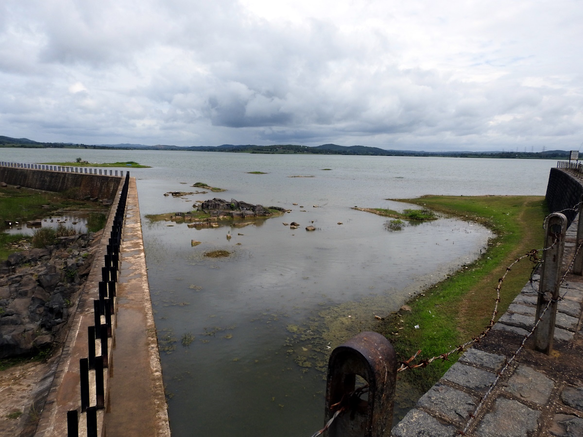
Aug 26, 2023. We left home around 10-45. The 15 km journey took almost an hour because we took a slightly round about route and we had to stop at the reservoir check-post for a few minutes. Somewhere on the way I'd seen a board stating Neerasagar waterfall. We headed towards the waterfall spot first, the dirt road ran parallel to the earthen bund (embankment) and then climbed up on to the southern end of the bund. A gate barred vehicle entry any further. This is the southern end of the bund, on the left is the overflow wall. As you see the reservoir is filled to capacity.
The on-duty guard told us that the reservoir was overflowing until a week ago, it was a sight worth seeing. I'll make it a point to visit Neerasagar the next time it rains heavily.
The overflow wall is around 280 meters long. The spillage flows southwards towards Kalghatgi and Mundgod. As per the information board here, the source of Neerasagar is Bedthi Halla. The word Halla means a stream. Bedthi can be called a perennial stream.
According to a Karnataka Aranya Elakhe (Karnataka forest department) board near Yellapur, Bedthi Halla's headwater (starting point) is near Unkal lake, Hubballi. Below is the transcript of the board.
ಬೇಡಿ ನದಿಯ ಮಾಹಿತಿ: ಧಾರವಾಡ ಜಿಲ್ಲೆಯ ಹುಬ್ಬಳ್ಳಿ (ಉಣಕಲ್ ಕೆರೆ) ಯಿಂದ ಹುಟ್ಟಿ ದಕ್ಷಿಣದಿಂದ ಪಶ್ಚಿಮುಖಮುಖವಾಗಿ ಹರಿದು ಕಲಘಟಗಿ ಯಲ್ಲಾಪುರ ಮುಂಡಗೋಡ ತಾಲುಕಿನ ಗಡಿಯಲ್ಲಿ ಹರಿ ಮುಂದೆ ಮಾಗೋಡ ಜಲಪಾತವೆಂದು ಪ್ರಸಿದ್ಧವಾಗಿದೆ. ಇಲ್ಲಿನ ಜಲಪಾತವು ಭವ್ಯವಾಗಿ 650 ಅಡಿ ಎತ್ತರದಿಂದ ಧುಮುಕಿ ರಂಜನಿಯ, ರಮ್ಯಮಾಯ ದೃಶ್ಯ ಗೋಚರವಾಗುವದು.  ನಂತರ ಅಂಕೋಲಾ ತಾಲೂಕಿನ ಗಂಗಾವಳಿ ನದಿಯಾಗಿ ಹರಿದು ಸಹ್ಯಾದ್ರಿಯ ಸುತ್ತುವರಿದು ಅರಬಿ ಸಮುದ್ರ ಸೇರುತ್ತದೆ.
From Unkal, Bedthi flows southwards touching Kalghatgi and Mundagod, then flows through Yellapur Taluq and creates a spectacular waterfall at Magod by plunging 650 feet in two stages. Further, on entering Ankola Taluq, it is called as Gangawali. After taking a circuitous route in the hills & jungles of Sahyadri Ghats, Gangawali touches the west coast and merges into the sea.
Magod waterfall is a sight to behold, I'd seen the waterfall two times, about 13 years ago. Coming to Neerasagar, impounded by the dam, Bedthi is a humble brook here. That's Srinu crossing over to the left bank. After a good rain, fed by smaller streams, Bedthi becomes a gushing stream. Going by the terrain she flows through, Bedthi can be called as the younger sister of river Kali.
The rocks in the stream bed caught my attention. These grey colored rocks with white streaks seem to be shale with calcite lines. The calcite deposits are so prominent, a real beauty.
The calcite streaks are several meters long at places. It's also possible the streaks are quartz deposits. Only a geological specialist could identify them correctly.
shale with calcite or quartz deposits
The predominantly dark grey rock-bed has patches of brown at places. Those patches have wood like look. In this picture below, it looks as tough the white lines are embedded into wood.
A Neem tree on an outcrop. Plants prove their versatility by growing at unthinkable locations. In the background is Neerasagar overflow wall.
Less than 100 meters from the wall corner is the cascade. The brook takes small leaps from rock to rock making gurgling sounds on its way down. Though a small cascade, one needs to be careful while negotiating these rocks. These rocks could be slippery due to smooth surfaces or layers of moss. On a cool day one could sit here hours together listening to the soothing music of water & stone.
The brook flows down and collects into a small pond and continues it's journey towards Kalghatgi.
The stream bed was getting warmer by the minute due to radiation. We decided to move on and see the reservoir. Neerasagar dam is an earthen type. The bund is 1.35 km long and 155 meters wide at the base and 6.1 meters at the top. The catchment area is 181 sq km, no idea what the average depth is.
The dam is under watch always. there are guards watching the gate here and the gate-house situated at the mid-point of the bund. A cement pipe fashioned into a sentry post is a real piece of art. Had it been painted, white shaft and red cap, it would've looked awesome. Being a Saturday, there were a number of visitors, mostly youngsters from Dharwad and Hubballi.
Another view of the bund and the gate-house. On the northern shore of the reservoir are farmlands growing sugarcane and maize.
View of the service road from the bund. This picture was shot in Srinu's mobile phone as I drove down. I would be meeting him at the mid-point where the steps and gate-house are situated.
The service road and the well maintained bund. There were a team of a dozen people pruning overgrown vegetation. Neerasagar is one of the sources of drinking water for the rapidly growing twin cities, maintenance is a year round work.
The iconic three-stage staircase of Neerasagar. The function of the stages is to stop anyone falling down or to reduce the speed of water during a heavy downpour. 
Another guard on duty. The guards need to be alert keeping visitors within limits. There are two information boards planted on either sides of the staircase, one in Kannada and the other in English. The other board is notice to public- this being a source of drinking water, no people are allowed to enter it, bathing cattle or fishing too aren't allowed.

Here's the transcript of the English board:
KARNATAKA URBAN WATER SUPPLY & DRAINAGE BOARD
NEERASAGAR WATER SUPPLY SCHEME: HUBLI-DHARWAD
TOTAL COST OF PROJECT: I STAGE RS. 170,50,000/- (COMPLETED DURING 1955)
                                     II STAGE Rs. 48,17,000/- (COMPLETED DURING 1969)
DETAILS OF NEERASAGAR LAKE & EARTHEN BUND
1. SOURCE: BEDTI NALA
2. LENGTH OF EARTHEN EMBANKMENT: 1356.36 M
3. CATCHMENT AREA: 181 08 SQ.KM
4. AVERAGE RAIN FALL: 750 MM
5. STORAGE. CAPACITY: 28.90 MCUM
6. USABLE, STORAGE: 26.15 MCUM
7. MAX. HEIGHT OF DAM BUND: 24.60 M
8. MAX. WIDTH OF DAM: 155.33 M
9. RL. OF TOP OF DAM: 594.66 M 
10. FLOOD LEVEL: 592.53 M
11. FULL SUPPLY LEVEL: 590.70 M
12. TOP WIDTH OF DAM BUND: 6.10 M
13. OUTLET LEVEL: 1. TOP : RL 589.17 M
                             2. MIDDLE RL 585.36 M
                             3. BOTTOM: RL 580.94 M
14. SIZE OF OUTLET: 750 MM DIA CI PIPE LENGTH 1.45 KM
ASSISTANT EXECUTIVE ENGINEER, (CENTRAL) HUBLI.

As I scanned the surroundings through my camera lens, this young-man gestured his request for a picture. Selfies are good but nor as good as being photographed. Shubam is from Yellapur studying at Dharwad. He likes traveling and I guessed it rightly that a Himalayan bike parked near the staircase was his.
Time to leave. I thought of a picnic plan here with Pushp, one of the Sunday for sure.
At the vehicle parking spot, we ran into this group of students from KLE, Hubballi. I asked them if they had bunked classes. No, they hadn't. Srinu joined them for a picture... Srinu Sir & his students on an outing.
We said bye to our friends and we headed home for a light lunch and nap. Later I sent pictures to Shubam and Kiran, the guy on Srinu's left. The following day Srinu, Pushp and I went bicycling to Navalur Gudda. After the early morning bicycle ride, we had breakfast at home and went shopping at Dharwad Vegetable Market. We purchased a few things needed for the week and the upcoming two-day trip to Badami-Pattadakal-Aihole.
.........

Feb 25, 2023

Maari Kanive Dam and Vani Vilas Sagar

Though we had driven past Hiriyur several times since my childhood days, we couldn't make a trip to Vani Vilas Sagar. I fact I'd not even seen a photo of it until 3 or 4 years back. When I read about the place, the urge to visit it got stronger but it was still a pending item. Then in the third week of January 2023 during my inquiry for Ficus Krishnae trees I heard from my cousin's husband that there was  a tree in a park near Vani Vilas Sagar dam. Around the same time, a long pending trip to Bengaluru was being planned, the Ficus at Vani Vilas Sagar was a catalyst in finalizing the trip.

Jan 23, 2023. I left Dharwad around 3-45 AM; my first stop was Sri Revana Siddeshwara Gudi at Dodda Bathi where I spent about 20 minutes; the next item was Sri Basaveshwara Gudi, Anekonda which I reached by 7-15, spent about 45 minutes looking in & around the XII Century artifact; then I drove out of Davangere towards Bengaluru. During my previous drive on this highway, I'd seen the new bypass around Chitradurga was being constructed. Now the new bypass road was open to traffic, we don't even get to see Chitradurga, a number of rock hills have been leveled to make this new road, its quite scenic but hurts to imagine the original state. That's the cost of development. At Hiriyur I got off NH48, drove through the town, found the road to Vani Vilas Sagar, which is a 20 km drive. By 10-30 I was at the spot, the dam came into view, on the left was a big Ficus with hundreds of aerial roots and on the right was Kanive Maaramma Devastana. 'Kanive' means valley, since the shrine of Maari is situated in a valley, the deity is called as Kanive Maaramma. And vice versa also applies... since Maari shrine is present here, this valley is called Maari Kanive.

I parked my car under the Ficus, next to which are a row of shops and tourism department park. Both park gates were shut which was little disappointing. How would look for Krishna Ficus without entering the parks? Luckily the tourism department park has a side entrance which is always open. I explored the park completely, no sign of Krishna Ficus here. The forest department park didn't seem to have any other gate, I thought may be today's not the day. So I headed towards the dam.

There are two flights of steps on either end of the dam wall and on either ends of the walls are two pillared halls, they are the viewing galleries built when this dam was constructed. One of the stairs starts just behind Maari Devastana and ends at the top of the dam. There's a fence restricting people from venturing beyond the viewing gallery. However on the opposite site, the staircase continues beyond the gallery, the elevated views from that side are captivating. This view below is from the gallery level.

At the base of the dam is a board which describes the dam as below:
ವಾಣಿ ವಿಲಾಸ ಸಾಗರ (ಮಾರಿ ಕಣಿವೆ) : ಜಿಲ್ಲೆಯ ಪ್ರಸಿದ್ಧ ಪ್ರವಾಸಿ ತಾಣಗಳಲ್ಲಿ ಹಿರಿಯೂರು ತಾಲ್ಲೂಕಿನಲ್ಲಿರುವ ವಾಣಿವಿಲಾಸ ಸಾಗರವೂ ಒಂದು. ಮಾರಿಕಣಿವೆ ಎಂಬಲ್ಲಿ ವೇದಾವತಿ ನದಿಗೆ ಅಡ್ಡಲಾಗಿ, ಮೈಸೂರಿನ ಮಹಾರಾಜರು ಕಟ್ಟಿಸಿದ ಅಣೆಕಟ್ಟು ಇದು. ಇದು ಹಿರಿಯೂರಿನಿಂದ 20ಕಿ.ಮೀ ಹಾಗೂ ಚಿತ್ರದುರ್ಗದಿಂದ 60 ಕಿ.ಮೀ ದೂರದಲ್ಲಿದೆ. ಇದನ್ನು 1898 ರಿಂದ 1907 ಅವಧಿಯಲ್ಲಿ ನಿರ್ಮಿಸಲಾಯಿತು. ಎಚ್.ಡಿ.ರೈಸ್ ಮುಂತಾಗಿ ಹಲವಾರು ಇಂಜಿನಿಯರುಗಳು ಇದರ ನಿರ್ಮಾಣದಲ್ಲಿ ಭಾಗಿಯಾಗಿದ್ದಾರೆ. ಈ ವಿಶಾಲ ಜಲಾಶಯವು ಎತ್ತರದ ಒಂದು ಬದಿಯಿಂದ ನೋಡಿದಾಗ ಭಾರತ ಭೂಪಟವನ್ನು ಹೋಲುತ್ತದೆ. ಇದರ ಉದ್ದ 1330 ಅಡಿ ಎತ್ತರ 162 ಅಡಿ ಇದ್ದು, ಅದು 25,000ಕ್ಕೂ ಹೆಚ್ಚು ಎಕರೆ ಭೂಮಿಗೆ ನೀರುಣ್ಣಿಸುತ್ತದೆ. ಇಲ್ಲಿ ಮಾರಿಕಾಂಭಾ ಮತ್ತು ರಂಗನಾಥಸ್ವಾಮಿ ದೇವಾಲಯಗಳಿವೆ. ಅನೇಕ ಭಕ್ತರು ಇವಕ್ಕೆ ಬೇಟಿ ಕೊಡುತ್ತಾರೆ. -ಜಿಲ್ಲಾಧಿಕಾರಿಗಳು ಹಾಗೂ ಅಧ್ಯಕ್ಷರು, ಜಿಲ್ಲಾ ಪ್ರವಾಸೋದ್ಯಮ ಅಭಿವೃದ್ಧಿ ಸಮಿತಿ, ಚಿತ್ರದುರ್ಗ.
Vani Vilas Sagar (Maari Kanive):It is one of the famous tourist spots of the Chitradurga district, situated in Hiriyur taluk. This reservoir is built across the Vedavathi river by the Maharaja of Mysore. This is 20 kms away from Hiriyur and 60 kms from Chitradurga. This was built during 1898 to 1907. Mr. H.D. Rice and other engineers took part in constructing of this reservoir. The water looks like India map when it is viewed from the top of the hill on one side. The length of the dam is 1330 feet and height 162 feet. It feeds water to the land more than 25,000 acres. Here are two shrines of the deities Marikamba and Ranganathaswamy which attract so many devotees. - Deputy Commissioner and Chairman, District Tourism Development Committee

The description however doesn't mention that Rani Kempa Nanjammani Vani Vilasa Sannidhana, the widow of king Chamaraaja Wadiyar, was one of the promoters of this dam project. It is said that Mysore Kingdom royal family has financed such projects even to the extent of pledging their personal jewelry to borrow money. 

The still waters of Vani Vilas Sagar. The reservoir is 16 km & 7.5 km at its longest & widest, and its gross storage capacity is 30.4 TMC i.e. when the waters have reached a height of 130 feet. This reservoir has 3 canals namely left canal, right canal and high level canal. In the picture below, on the left-bottom corner is the roof of the gallery.

View of Maaramma Devastana, a community hall and forest department park. According to one of the locals, Krishna Ficus trees should be situated in this park.

The dam gates are situated close to the left bank, next to the right angle bend in the wall.

Around the dam are several pumping stations supplying water to the three canals. The white speck just above the water surface is one such station.

The staircase is an artistic creation. The retaining walls porous, holds the earth yet allows rainwater to seep through. Such a construction actually prevents landslides and are long lasting. Assuming this was constructed a few years after completing the dam, this is almost a century old.

With a partially shaded staircase, climbing wasn't tiring. Also flanking the stairs are small terraces where I could catch my breath as I admired the elevated views. In fact these little shaded terraces is a nice place for picnic.

The right bank staircase ends at a the PWD Guest House gate which is usually kept locked. With the dam gates shut, the water surface was almost still. Any unevenness seen is due to air movement. A pleasant breeze would blow over the water from time to time.

This is the path along the PWD Guest House wall. This stretch too offers nice views, especially early mornings & evenings. The guest house seems to be well maintained. Once could obtain permission for accommodation from the head office at Bangalore.

This is the left bank staircase as seen from ground level. The dam wall must be at least 100' at its base, of course the foundation would be much wider. Wish I could see construction time photographs.

The old Ficus, spreading its wide, providing more shade below and accommodating more birds on its branches. Ancient superstitions around trees like Ficus, Banyan, Tamarind were justified because they kept unwanted people away, which was conducive for the trees' growth.

This is the staircase to Maaramma Devastana, situated close to the right bank.

A heroine-stone next to a Neem tree near the temple stairs. Looks like this warrior lady was martyred while protecting this shrine or a village close by. It was a practice in olden times to honor warriors with such memorials.

Despite all the modern facilities, this shrine has still retained some of its ancient features. I believe an annual fair is held here which attracts thousands of people.

Lastly, the forest department park entrance. I wasn't ready to leave the place without finding the Krishna Ficus. On my way out, I stopped here to peep though the gate grills. First I noticed the gate slightly ajar, I went closer and confirmed it. Yes, the gate wasn't locked.

I explored the park, starting from the left hand side and lastly coming to the right side. This park, a few years ago was superbly maintained. At some point after 2018 the neglect had begun. I could still see boards of theme parks like Nandana Vana, Gulabi Tota, Japanese Udhyana Vana, Ashoka Vana, Shiva Panchaya Vana and Bruhat Panchavati Vana. This is on the same concept as Deve Deva Vana near Bidar. The board "Bruhat Panchavati Vana" gave me hope, and to my delight there were four Ficus Krishnae trees. The discovery was a bitter-sweet experience, happy to have seen the divine trees and sad to be seeing their plight. To see pictures of the Ficus Krishnae, read the article on Ficus Krishnae trees at Mari Kanive Park.

.........
Jul 29, 2017

Submerged Madenur dam in Linganamakki backwaters

Until the day I received an email from my acquaintance Jayachanda N S from Shimoga, I'd never heard of a dam submerged in a reservoir of another dam. The email was an invitation to a trip to this submerged dam of Madenur. Unfortunately, I could not make it to the trip but Jayachanda shared some photos of the place. June end I chatted with Jayachanda on phone and requested his permission to post his pictures here.. yes.

Madenur Dam, also known as Hirebhaskar dam was built across river Sharavathi between 1939 and 1948. The dam was inaugurated in 1949 and remained functional until the much larger Linganmakki Dam came into existnce in mid 1960s. Now Madenur Dam remains submerged in the waters of Linganmakki reservoir only to surface when the water level dips during peak summer month of May. With some more research, I found Rajesh Naik's post on dreamroutes.org and learnt how the dam functioned.

The construction of Madenur dam was supervised by a civil engineer names Ganesh Iyer from the Old Mysore region. He was an expert in construction of structures based on the siphon system. The 1150' (350 meter) dam has 11 siphons, each 18' wide x 58' high. The mechanism of siphon system enables water to flow out of the reservoir automatically when it reaches the optimum level. Besides the siphons, there are 3 crest gates.

Here we go- the wonderful Madenur Dam which has survived 50 years of remaining submerged. In this view the river flows from left to right. The first siphon from the east end.

The siphon top. One can walk on the 2' wide bridges connecting the siphons but it can be very risky.

The stairway connecting the dam crest to the siphon platform.

The pillars around siphons. Each siphon has an outer ring of 12 pillars. The inner wall is the well through which water flows out.

The cement structure has survived the test of time and water. Appreciate the project team's work.

View of the dam from the reservoir.

The domes of the siphon; whoever designed this structure had a sense of aesthetics too.

Finally, the twelve siphons in a single frame.

The dam and siphons as viewed from air. Courtesy- Google Maps via Wikimapia.org.

The other side of the dam.. i.e. the tailrace. It is said there's an ancient temple submerged close to this dam.

Jayachanda locates a hero-stone.. some where on the reservoir bed.

My thanks to Jayachanda for these lovely snaps. Hopefully, one day I shall make it to this place and the nearby forts of Nagara and Kaveledurga.

.........

Dec 31, 2016

Pocharam Dam, near Medak

The small dam near Pocharam village is across river Alair, a tributary of river Manjira is commonly known by the name Pocharam Dam, it is about 16 kms from Medak town which in turn is about 100 kms from Hyderabad. The dam was built by Nizam of Hyderabad between 1916 and 1922. The dam is simple in design, its made of coarsely dressed granite blocks and lime mortar. The reservoir covers an area of approximately 11 sq. kms and has about nine small island in it. On the eastern bank, within the dam's sight is an abandoned bungalow of Nizam. When the reservoir is filled to capacity, excess water simply flows over the wall. However, at the western end of the dam are gates which can be used to let out water when the water level is below the dam's wall height. The reservoir is surrounded by jungle which is home to a wide variety of wildlife such as wild dogs, leopards, wolves, jackals, wild cats, sloth bear, and varieties of deer. The reservoir attracts water-birds like geese, egrets and cranes. In 1952, Pocharam Wildlife Sanctuary was established.

August 14, 2016
We were on a day trip to see Medak fort and Medak cathedral. Akshay suggested a must see spot near Medak and  that was Pocharam Reservoir. So after the trip to Medak Cathedral and Medak Fort, we drove towards Pocharam. The road was in good condition, it was a smooth drive on a not so busy road. We passed by the fenced borders of the Wild Life Sanctuary. I was hoping to see some deer and peacock, could see none, may be at this time of the day they are deep in the woods. We drove across the river and reached the dam project colony, that's where we realized having missed the road to dam. We turned back, drove across the river and then found a dirt road on our left. It was a narrow uneven path fit for off-road vehicles.. it was a slow drive avoiding the pits & mounds. At one point the road goes across a stream path, a kind of bridge cum wall was built across to facilitate movement of men and vehicles. When the reservoir is up to capacity, excess water flows there. I missed taking a picture of the spot :( Anyway, from the stream the dam is 150 meters, the path ends at the abandoned bungalow. There were 3 or 4 more cars and a dozen bikes already.. people we already flocking in with their picnics.

As we were getting of the car, we could see lot of cream-colored insects flying about. Akshay took them for mosquitoes but some villagers hanging around the place confirmed they weren't mosquitoes, no need to worry. It was nice to see so much water and greenery, felt great to be breathing in fresh air blowing over clean water. It was cloudy with chances of light rain. Good that public was allowed to walk over the dam. The wind was strong at moments, we maintained distance from the edges. The wall is about 16 feet wide and 630 meters long. Water level was about 12' to 13' below at this point where we stand. In the back-ground is the bungalow surrounded by trees.

We'd walked about 200 meters when it started raining, we turned back and rushed to the nearest tree's shelter. The rain lasted few minutes but the cloud cover remained with the Sun peeking out now and then. Back on the wall, all signs of rain was erased by the wind. More cars and people were flocking in..

A flight of steps barely 7' wide with no railings. One person at a time, no side by side walking.

Some brave hearts rode their bikes. Going by the looks, the wall looks solid, it seems to be built at the edge of a rock bed.

We went down the steps to get another view of the dam. Impressive piece of civil work. Its is possible the dam design might have been reviewed by Sir M Visvesvaraya.

There's Pushpa resting on the steps while Akshay chats with a biker from Chennai named Rajnikanth. The biker was on a solo trip on his Enfield Bullet. Notice the wall and floor.. so similar to fort walls.

We are almost at the other end of the dam now. On the water side of the wall is a mechanical device. Apparently it looks neglected and may not be in working condition. It seems like a gate system to control water flow.

The bevel gear and threaded shaft inside these housing hasn't seen grease for years. It definitely seems like a gate-lifting device currently out of commission. Notice how the wall slopes to the right, to allow easy flow of water across the wall. At the far end is the mound of Nizam's bungalow.

We were on the return trip across the wall when I wanted to climb down the steps to the river bed. Two young adventurists started climbing the wall. The closer one here climbed rapidly, very confident. It was a scary sight.. no safety gear whatsoever.

Our climber almost reached the top. Unfortunately, the top 7' or 8' of the wall slopes backwards and that's where his climb ended. There was no way he could move up without a rope. Now comes the difficult part.. descending this would be crazy! Nothing deterred this guy, he made his way down slowly and safely.

Here's a view of the dam seen from the river bed. That's actually a bridge on the dam which lets people walk on the dam when its overflowing.

I was glad to be here, thanks to Akshay. It was nice to spend time in Nature, good break from the hustle bustle of metro life. A family of four were happily enjoying their moment on the rocks, with their feet in cool water and sheltering themselves from the drizzle.

Pushpa had packed our picnic of jolada rotti, madaki-kaal palya and junaka. We found a shaded spot on a rock near the bungalow. It was rather a dry lunch without curds or salad but the items were tasty. After lunch, we rested for a and then I pitched stones over water, a kind of ritual whenever I'm at a lake. The water was choppy so pitching stones was a challenge. Pushpa also tried and succeeded :)

We left early so that it would still be light when we reached home. Driving at night can be tiring and it takes off all the fun we had during day.

.........