Ratnagiri hill fort has a perimeter of about 4.5 kms, it spans across two hillocks and plain land. On plain land, along the fort walls runs a moat. Within the fort is part of the village.. probably original settlers.. an online source says that after the fall of Vijayanagara kingdom several hundred Brahmin families settled at Ratnagiri. Coming back to the terrain, the hilly part of the fort has three levels and right now I'm at level 2 and about to climb to level 3 - the summit. In this picture, the steep flight of steps hewn out rock is visible clearly. Probably this is the only way to the summit. A closer view of upper half the stairway (see inset).
At the end of the stairway is a gateway, its in pretty bad shape, I'd to clamber over rocks to reach it. This part can be dangerous in wet conditions. For that matter, its best not to attempt this stairway if rocks are wet.
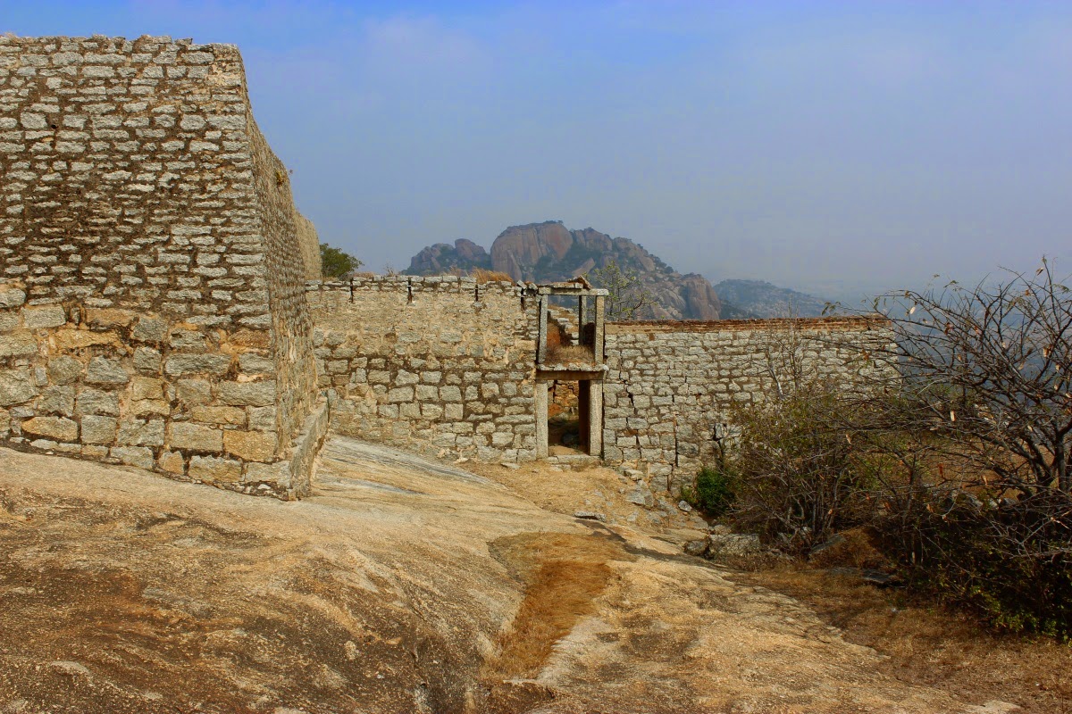
View from the gateway: Looking down towards level 2.. the two buildings are in fairly good condition, they might have been used as soldiers quarters or for storing food grains/armaments. Also there's a small temple. Probably more buildings were to be built.. abandoned for some reason.
Now I've entered the core fort, the summit, its not a large area here, one roofless structure and a conical bastion stand here. There's a small structure with sloped roof, probably a rest-house for soldiers. Tanks to harvest rain water is present. These structures seem to be built some time between Vijayanagara rule and Hyder Ali or Tipu Sultan's rule. The gateway seen here is a multi-storey structure.
Panning to the left the bastion comes into view. The bastion must have had a stairway to its top but I could not see one. On the bastions right side, on the walls are two vertical channels.. probably to direct rain water flowing down from the roof. On the left side, away from the walls is dome-shaped structure with a small opening, inside it has a shallow pit. I remember seeing similar domes at Madhugiri. I think they were built to store grains or oil.
I was quite surprised to see this group, was not expecting to see people here. They were Telugu and Kannada speaking folks from a nearby village, they had come to see the fort. I sat down in the shade few minutes, cooled off and had some water. Wind was pleasant up here.
Close where we sat was the rampart wall.. portions of which had fallen off. Level 2 wall is visible. Rampart walls run down this hillock and then climb up the neighbouring hill seen here. I won't be able to explore the entire fort :( time is always a constraint. The spot from where I shot is an extension of the wall.. not exactly a bastion but a watch point. See inset for a view of outer surface of the wall.
View of the fort in plain land, original Ratnagiri village is within the fort walls. The large square structure close to the center of the picture is the main gateway of the fort. I'd passed through it an hour ago. At the bottom right corner is another gateway. Besides gateways bastions are also seen. Running along the wall is a trench - that would be the moat..
View of the rampart walls joining the hill. On this part the trench is quite shallow, probably it was filled in.
Turning our attention back tot the summit; this is the western section of the summit. A sloped roof structure.. probably a rest-house for guards. Just behind the rest-house is a turret, design is typical to Tipu occupied-altered forts. View of the rest-house from the rampart wall (see inset).
Next to the rest-house are two water tanks of unequal sizes. Water lines of the rocks/walls indicate tanks were full often. Indeed very effective rain water harvesting systems.
Central bastion as seen from rampart wall, water tank in foreground. If you look beyond the structures, the neighbouring hill's peak is visible. Looks like the other hill is slightly higher than this hill. A closer look at the domed structure next to the central bastion (see inset).
A pair of feet engraved on the rock close to the central bastion. Behind the feet is a set of lines which look like text but the text is not engraved, rather it seems embossed. Is this pair of feet created in memory of some holy man who had visited this spot? I have a feeling this feet marks the stay of a Jain monk.. saying that because of the presence of the Jain Basadi in Ratnagiri village.
View of rampart wall and bastions connecting the two hillocks. I wish I had time enough to explore the entire fort.. might have required another hour and half easily.
I decide to leave.. paused a while at the gateway. Wondering what's the idea behind having a two storey gateway.
Descending the hill was fast, Soon I was on plain land between the two hillocks. I spent some time at this here at the Kalyani but skipped venturing into the Mantapa and temple.
This the fort's main entrance, it has the typical zig-zag path. I should have stopped and checked for inscriptions in the gateway. I must remember to visit this place whenever I'm in the vicinity.
A hero-stone close to the fort's main entrance; it shows four characters- a prancing horse, a royal couple, and an attendant. It looks quite recent.. may be 200 to 250 years old.
Truly Ratnagiri was a formidable fort during its heydays. No wonder it was a power center for Choals and Pandyas. Surely Nayakas would have controlled it at some point of time. Hopefull I'm here again and explore the remaining parts of the fort.
Ratnagiri fort coordinates: 13°48'52"N 77°7'45"E
.........