Showing posts with label hill fort. Show all posts

Feb 5, 2022

Fort Machigad part-3

 ...continued from Fort Machigad part-2.

In the earlier parts i.e. part-1 & part-2, I've covered about coming to Machigad, meeting my host Kalmeshwar, ascending the hill and the tour of the fort covering several key spots like the Mahadwara, Hanuman shrine, Mata Mandir, Raamteerth view points, a rock-cut water tank, turret at the highest point of this fort. Raamteerth is an ancient shrine on the neighboring hill. Now we are on the western side of the fort trying to find the way forward through the ruins & vegetation. Kalmeshwar surveys the scene and says we have to turn back and retrace our way for a short distance.

We had to clamber up a few rocks pretty close to a drop and then tread over some more rocks and descend to the dirt level. We walked along the wall to a small doorway on the southeastern side. Kalmeshwar called this as a Chota Darwaza or the small door. There's a way to Raamteerth from here. The path goes through the jungle, only a person familiar with the route will be able to find the way.
This is the exterior view of Chota Darwaza. The doorway is designed in such a way that it remains hidden. It would be recognizable only from close quarters, that too in one direction. Back then, this doorway would be closely guarded day & night. Coming to the jungle, I'm wondering if Machigad was surrounded in forest during its heydays. The jungle could be a layer of defense or camouflage for enemy soldiers. We did not venture away from this doorway but we back inside to continue with the tour of the fort.

Kalmeshwar wouldn't say what came next, the element of suspense was a good idea. We came to this clearing, it slopes down, a nice mat of grass. It was easier to walk here.

The clearance as seen from the other end. Kalmeshwar spotted a tortoise. For me it was a big surprise... tortoises on a hill!? The shell was covered in dark green muck which was still damp. He picked a stick and prodded it gently hoping that the tortoise would stick its head out. No way. We decided to leave it alone and move on. There has to be water source close by. Yes, it was a stone's throw away.

The clearance was arc shaped in elevation. At the lower end was the second rock-cut water tank. This was slightly smaller than the one seen earlier. Also this tank was filled with grass, surely there would be mud at the bottom of the tank. Also, there's a natural pond besides the rock-cut tank... that's what Kalmeshwar is peering into.

The tortoise must've ventured out of this dark murky water. It must be a good climber to have ascended that slope on the right. I asked why would a tortoise come out of water other than to soak in heat from sunlight. He said food. I asked if the water had fishes. No. Tortoises com out to feed - that was new to me. They might feed on insects, snails and may be some plants too. This waterhole was the end of the trail.

On the way back, we took the same route except the last bit where we had taken a slight deviation to see Raamteerth view point. We found these quills stuck in the ground, five or six of them. Possibly a porcupine had fired off its quills in self defense, a few might have hit the target and a few hit the ground. I asked Kalmeshwar if I could take a few. He was okay with it. I looked around, found a PET water bottle. Pulled out three quills and dropped them into the bottle and capped it. This would be a nice souvenir. A thought occurs- a porcupine left a few quills which will decay and mix with dirt, no traces left. On the other hand, humans had littered the place with pet bottles and plastic bags which will stay as is for centuries if not millennium.

The descent was faster than ascent, naturally. I loved this part of the trail. A little further I saw this flower on a small tree, very few leaves and fewer flowers. From a distance Kalmeshwar had mistaken the flower for some new kind of bird. I'm sure he's seen some rare and beautiful birds here.

I was tired after the 8 km trek to Raamteerth and then Machigad climb. I was looking forward to sitting in my car but I still had a small thing to complete. We went towards Kalmeshwar's home where we met his father Rajaram Hanabar and another gentleman named Rajaram Shinde. I thanked Shri Shinde for appointing Kalmeshwar as my guide. If not for Kalmeshwar, I wouldn't seen machigad the way I saw it. Mr. Shinde left.

Mr. Hanabar invited me in for a cup of tea. I was happy to be sitting. Tea was good, sugary & hot. We chatted about life in Machigad... rains, agriculture and stuff like that. Also he mentioned about the Jatra at Raamteerth on Makara Sankranti. I thanked the father-son duo, exchanged phone numbers and left.

It was a well spent morning, plenty of physical activity for my legs. I headed towards Halasi where I would be seeing the Kadamba temples, the chief one being Bhu-Varaha Devastana. I had to eat lunch as well, thankfully food & water was in the car, I had to find a peaceful spot. 

.........

Feb 2, 2022

Fort Machigad part-2

 ...continued from Fort Machigad part-1. In the first part of this article the parts covered are- reaching Machigad village, meeting my host Kalmeshwar, ascending Machigad hill, reaching the main entrance (Mahadwara), the remains of the inner doorway, saw Hanuman shrine and Mata Durga Mandir, spent a few minutes at the first Raamteerth view point and then came to this rock-cut water tank This water tank becomes a swimming pool for the village boys during summers. Of course the water tank is cleaned and maintained by village people so that they have water up here.

The vegetation is so thick that rampart walls are hidden at most places. This is one spot where a bit of a wall is exposed.

Now we are moving to the south western side of the fort. There's a large rock formation along the outer wall. Atop the rock formation is a turret. I think the turret (see inset) is the highest point of this fort. That's my host Kalmeshwar leading the way.

Kalmeshwar climbs up the boulders which is a natural defense line. This part can be very tricky during rains... very slippery surfaces. 

To the left of where Kalmeshwar is standing is a gap in the rocks which has been blocked by a wall. The wall may look low from here but its high because its base is much below, out of sight from where I was.

This rock looks like a camel's hump. This spot is the second Raamteerth view point.

The hill seen in the background is Raamteerth hill. It gets its name because of the Ramlingeshwar Devastana there. The place is truly enchanting, especially early mornings and evenings.

Out there, there are three temples, two completed and one incomplete. Also, the temples stand right besides a water tank which is shaped like a large bowl in the rock, These temples were built during Goa Kadamba rule in the XII Century CE. I was there a few hours ago. To reach the temples, one needs to trek approximately 4 km through paddy fields and jungle.

Panning to the right, the neighboring hill comes into view. In fact, Machigad and Raamteerth are part of a group of hills which are closely connected to each other. There's a route from here to Raamteerth. People familiar with the route will be able to guide. May not be advisable for strangers to try any adventures here.

Below, there's another rock formation. It has a scary look. Below the huge rock is a cavern, a dark one. Kalmeshwar mentioned that cavern would be bears' home. Talking of wildlife, these hills are home to a variety of fauna like leopard, bears, porcupine, hare, wild cats, boars, snakes, wild fowls, peacocks, and many more. During my treks to Raamteerth I've seen long tail feather birds fly off suddenly. One of them had  two-feet long white tail feathers.

We move on... our path went through a green tunnel. This would be a good place to rest but we kept moving.

Once out of the tunnel we come to this drop. This is one of the few open to sky spots on the outer wall. We had to climb down, to the ground next to the wall. The descent was about 15 feet but crazy. I stuffed my camera into the bag and then climbed down carefully.

Atop that rock formation is the turret, the highest point of Machigad. Had we come earlier, I might have tried climbing up there.

That boulder is like a water drop. A minute ago I were next to that boulder. Lot of crevices between these boulders. One needs to be really careful not to fall and get stuck between those rocks.

This wall is built of rough stones, probably left over pieces. The builders, very skilled hands, have done a superb job. This crude looking wall could be standing for the past 500 to 800 years, or more.

This space is a great sentry point for watching over the western plains & hills. Any movement could be spotted easily from up here. This view is in the general direction of Anandgada fort near Nanadgad which I has visited in Feb 2014. The similarities between Anandgad and Machigad are- both situated on hills and surrounded by jungle. Anandgada is harder to reach because the dirt road which passes over few hills is approximately 8 km. I think most forts in the western ghats are on hills & inside jungles.

This happens to be my favorite picture of all the pictures shot at Machigad. The jagged but elegant curve of the wall and then the curve of the stone. At the base of this wall is a hole. I think its has been provided to drain out rainwater.

We walk along the wall and descend a little again. There was a doorway like opening in the wall. I asked Kalmeshwar if it was a secret passage for escape. No, its just a little chamber. May be a rain shelter.

I was expecting we would continue along in the same direction but our path was blocked by thorny bushes. So we had to turn back, retrace our way until Raamteerth view point. We'll continue the exploration in the following post- Fort Machigad part-3.

.........


Jan 29, 2022

Fort Machigad part-1

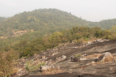
Machigad is one of the small hill forts of Belgavi district. It is about 4 kilometers from Halasi. Machigad hill and Raamteerth hill are part of one group of hills. Machigad is the highest hill of the group. The hill seen in the below picture is Machigad, the fort ruins are concealed in the thick vegetation. This is the view of Machigad as seen from Raamteerth. As you see the hills are joined. In fact there's a direct route from Raamteerth to Machigad fort through the jungle. Only a local who has traveled in that path will be able to guide.

December 15, 2021
My day started with a trek to Raamteerth which is about 4.5 km from Halasi. By the time my trek ended and I returned to my car it was around 11-15. I had breakfast and contemplated the next destination- Machigad or BhuVaraha Devastana at Halasi. I decided to check out Machigad. I'll climb the hill if the trek was short and if a guide was found.

At Machigad, I happened to meet two gentlemen named Rajaram Shinde and Rajaram Hanabar. The latter appointed his son Kalmeshwar as my guide. This is Kalmeshwar leading me to Machigad fort. These steps were laid out recently so that people can ascend the hill comfortably. People here usually go up to the Mata Mandir inside the fort premises.

The steps ended in 5 minutes. From here steps have been made into the dirt, slabs will be laid out soon. I was trying to imagine the dirt path without steps... it could be slippery even during dry weather and perilous during rains. 

The dirt steps too ended a few minutes later, then it was just dirt path but not too steep. At one point the village comes into view. The cement road is the approach to the fort, my car was parked at the end of road in the village.

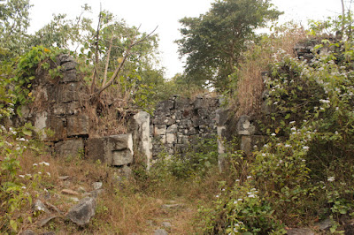
As we climbed higher there were two or three hairpin bends in the path. Most of the way the path was flanked by walls of vegetation. Then suddenly the ruins were seen. The entire climb- from the village to the fort gate lasted 11 minutes. The walls are made of semi-finished granite blocks, probably sourced from this hill and also brought from Raamteerth side. Kalmeshwar waits while I take a few pictures. Only a hundred feet of wall is seen, the rest is lost into the vegetation.

It's a zigzag path into the fort. The walls, though made of rough cut blocks have a plain surface so that they are not scalable easily. The approximate age of these ruins could be 500 to 800 years. They have withstood the test of Nature. This hill can be very damp and wet during rainy season, yet the walls are almost intact.

Close to the fort entrance, on the left hand side is a shrine dedicated to Hanuman (see inset). Its a rule that every fort has a Hanuman shrine as a mark of strength and valor. Kalmesh removed his sandals at a distance, went to the shrine, removed dried flowers and did Namaskara to Hanuman. I guess all people of this village are quite religious here.

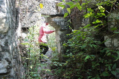
This is the second or the inner entrance. The distance between the two gateways could be 80 feet. I'm trying to imagine the massive wooden gates manning these passages. Probably the entrances had arches as well, which are not seen now.

The other side of the inner entrance. Seems like the inner walls are more damaged than the outer walls.


This is the second shrine of this fort. This little temple is dedicated to Mata Durga. Kalmeshwar went inside the temple, swept the floor clean, did Namaskara to Mata. He seemed so genuine with his emotions when it came to religious matters.

Next we head towards northern side passing over this rock. Kalmeshwar wanted me to see his village from here.

That's most of Machigad. The village is surrounded by paddy fields. Most people here speak Kannada and Marathi. We see lot of RCC houses now but if we go back 20 years we would've seen mostly tiled roof houses.

Kalmeshwar is doing PUC II in science. He has plans to do BCA. I felt it was a good choice. He said that he and friends spent their holidays on the hill.. this spot below is one of their favorites because of the view it offers. He said this spot was too good for photo shoots. Yes, he was right!

A bed of rock and an open view of the surroundings. It was a hazy day, clouds of mist shrouded the hills and plains. I liked the ambiance of this spot. However, we did not stop any place for long.

Raamteerth was visible from the spot. However, trees in the foreground blocked the view. Kalmeshwar said there's another spot which gives a clearer view of Raamteerth. We would be heading there next.

The photo shoot spot. Indeed its lovely.

The granite bed had lot of white bands on its surface. Must check out how these bands occur when the stone is formed.

Kalmeshwar led and I followed. He knew this fort like the back of his hand. The terrain was uneven, up & down, twists & turns, we had to bend to dodge thorny branches... it was a good exercise.

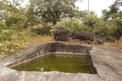
Then suddenly this marvelous little tank came into view. A hollow created by hacking out tons of stone. The tank must be 10' long, 7 ' wide and 6' deep which means its capacity is 11800 liters. Water was little greenish, that's because of the moss at the bottom. There was no odor as such. It seems this becomes a swimming pool for village boys during summers.

Rock-cut water tanks are wonderful creations. It may not be as easy as it seems. The stone workers need to know how deep the stone is. Wonder how they found out. And, I think this work was assigned to apprentices under close supervision. The other forts which have rock-cut tanks are Chitradurga fort and Chandragutti fort.

We has seen approximately half the fort. The tour will continue in the following post - Fort Machigad part-2.

.........

Mar 5, 2016

sights at Channarayanadurga

December 28, 2014

early morning sky
Sunlight breaking through clouds
golden rays light up dry grass
dry arrow tail grass flower
grass flower remains at ant nest entrance
life on rocks n bricks
formidable ferns
original yellow
a succulent in full bloom
Eranna Junior with his friend
See Channarayanadurga fort.
.........