Our visit to Shivappura fort was the end of my hunt for Kumara Ramana Kote - a fort deep in the rocky hills of Koppal district. The temple priest had told the fort is near Hemagudda. While Hemagudda is on the left-hand-side of Koppal-Gangavati road, Kumara Ramana Kote is on the right-hand-side. That hint was a big help in locating the fort on Google Maps.
December 22, 2012
Our journey started at 4-30 am and just as we crossed Hubli we had a flat tire. The 20 minute stop included a tea session... hot black tea tasted great in the cold weather. Kumara Ramana Kot was at the top of the list. By 8-15 we were entering the dirt road leading to our destination. After a kilometer or so the path became rough for our Indica. Having parked the car to a side, we were wondering how much further to the fort. We heard a tractor from the fort side :) It's another kilometer to the base of the hill. We had warm upit and tea, seated on rocks, with natures music in the back ground - chirping of birds.
Ravi opted to stay back with his car, so it would three of us Moham mama, Malatesh and I. Just as we started our trek we met a man walking in the same direction. He was heading to his fields near the fort. Great! We got introduced and asked our friend Sanjeevappa to show us the fort. Yes :) barri sir, namma Ramana area nodri idellla, avan permission ilde illi yaaru barangilla. With Sanjeevappa talking continuously, we barely felt the 15 minute walk.
Now were are at the base of the fort hill, the outer wall can be seen to the right. Note the rocky outcrop and a bastion at on the neighboring hill.
That's Sanjaveepa showing us a Seetaphal.
On hill path was rough but not very steep.
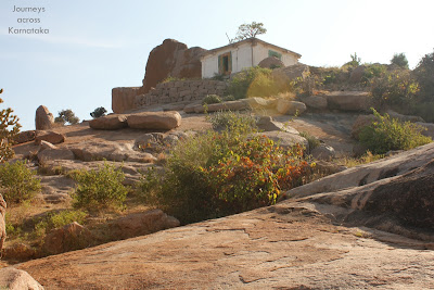
We reached a small plateau, we still had the second half ahead of us, to my right. In the background is the natural shelter on the neighboring hill. The more I saw it the more I felt it is a prehistoric site.
A wall between two massive rocks. A gateway let us into the inner fort.
An ancient temple with a modern touch. Its a north facing two chambered temple with three doors. Can't remember the deity, local folks perform rituals regularly.
Close to the temple, Sanjeevappa showed us bear droppings.. bears come here at nights to lick oil off the lamps. Behind the temple is a pair of massive rocks.. another gateway.
That's Malatesh next to one of the rocks. Some where in the background, hidden behind the rock is Shivapura fort.
Now we are the summit, its a wide uneven plateau with the inner fort located at the center.
Sanjeevappa told us 'Gandugali Kumara Rama' movie was shot here. Shivarajkumar son of Dr.Rajkumar, played the role of Kumara Rama. Sanjeevappa tols that while shooting was happening here, Dr,Rajkumar passed away at Bengaluru.
Within the inner fort is a pond. Fort walls are in bad shape. It was getting pretty warm here in spite of the breeze but there was no shade nearby. Sanjeevappa insisted us to walk a little further to see another pond.
Here it is- Ramaswamy pond. Water was clean and definitely looked cool. Sanjeevappa had a quick wash and gulped down several mouthfuls.
The pond is located on the southern slope, a short distance from her is the fort wall. Far away beyond the horizon is Hire Benkal and the hill of Moreyara Mane ~ megalithic tombs.
Mini forest on the hill slope and paddy fields hidden between hills.
A short climb back towards the fort is an open air Hanuman temple.
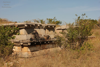
The temple has Jaina images on the door frame. Notice the columns, they are different too. So this might be a much older temple. However the temple is badly vandalized.. obviously treasure hunters. Garbhagudi floor has a large pit with a Jaina image lying in it (see inset).
Close to the Jaina temple is another pond. This fort has plenty of water sources. In the background, at the farthest point is a hill- that is Hemagudda.
Ruins of a watch tower. this seems like a relatively new construction.
Foundation of a temple. Something grand was planned but for some reason abandoned.
A small tank. Twin rocks with the gateway can be seen.
Mama was sitting in the shade all the while. We regrouped and descended. At the base of the hill, we said bye to Sanjeevappa who headed towards his fields. Without Sanjeevappa's company our walk back to the car was not so lively. Sun was blazing down fiercely and we yearned for the comfort of the car. Ravi looked fresh after a nap.
We drove back towards the highway with Sanjeevappa's voice in our ears.. neevu Kannadavru antha kote thorasde. bere yaaradru bandu englishalli kelidre, kote allaiti hog nodri anta hel-kalisirtidde. Sanjeevappa made our day :-)
To see the video, click on Kumara Ramana Kote.
Kummatadurga fort coordinates: 15°24'28"N 76°22'30"E
.........


4 comments:
Nice to read about Kumara Ramana's Fort. This place is there in my list of fort to visit .
How much time trek from car parking
Nice. You should use a tripod also in such shootings, because tight close-ups are always shaky due to the shaking movement of the hands and body. These days, you get very good tripods for less than two thousand rupees! But that enhances the quality of your picture a lot. Thanks for such a video!
thank you TGS and Trekkers Journey.
We walked about a kilometer to reach the base of the hill. however, with a SUV one should be able to drive till the hill.
Post a Comment