Three years back while researching forts it looked as though Uchangidurga and Uchangipura were one and same. However, later it turned out to be two different locations. Also, I learnt that Uchangipura was also known as Hosadurga.
March 6, 2013
After the lunch break at Uchangidurga, we made our way towards Hosadurga. The fort was visible from a distance since it was situated on higher ground. To our cab driver Ravi, the bastions looked like banavi ~ stacks of stalks like maize or jowar. Anyway, I was glad to have reached the fort without much effort.
The fort was a stones throw from the main road. We parked the cab close to the fort. That's Malatesh; wondering what to shoot in these ruins, there's nothing much left of the fort.
A rough plan of Uchangipura fort.
A gap in the wall looked like the main entrance - marked A in map. It's interesting to see how stones are packed to form a wall.
This fort seems to have had a moat, but the pit is shallow.
It's common for strangers to attract attention at remote locations. Three men turned who were supervising the road work close by turned up, curious to know the purpose of our visit. Same answer- historical. In the center is a tower, marked B in plan.
Total ruins, walls have collapsed and now they seem like a heap of rubble. Going back in times, I think Hosadurga might have been a garrison for Uchangidurga fort.
This skeleton is on the southern wall. I'm not sure if this ancient or recent creation.
We move on to the eastern wall, the well preserved wall of this fort.
This is probably the largest bastion of this fort.
Nothing much to see here, even the people could not help us with any useful info like when this was built or who built it.
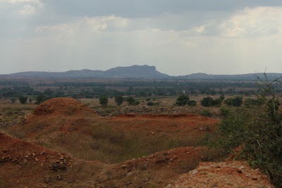
Uchangipura offers a great view of Uchangidurga, Surely these two forts were connected in the past.
Video by Malatesh.
We say bye to the village folks and move on towards Kanakuppe fort.
Uchangipura fort coordinates: 14°36'6"N 76°9'8"E
.........


No comments:
Post a Comment